New: IENC-charts from Rijkswaterstaat and WSV on watermaplive.net
watermaplive.net has now been expanded with the Inland ENC navigation maps from Rijkswaterstaat. They contain a lot of detail about the water. You can easily turn this on as an extra map layer. That's how it works.
Dutch Version 🇳🇱 | German version 🇩🇪
IENC (Inland Electronic Navigational Chart) charts are a household name in the nautical world, these charts are issued by governments to help skippers navigate the waterways. Rijkswaterstaat has also been issuing these maps for years. Until recently you could only get them as a separate download, after which you had to import them yourself into your navigation software (such as OpenCPN). But that process is quite cumbersome.
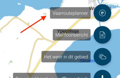
From now on you can consult the IENC maps much more easily, via watermaplive.net. This can be done very simply as an extra map layer that you can place on top of all other map layers. So whether you use the cadastral map, the topographical map or even the aerial photo map: it doesn't matter. You can project the IENC over anything. It works very simply: at the top right of the water map you see the map selection block, if you hover over it with your mouse it immediately expands:
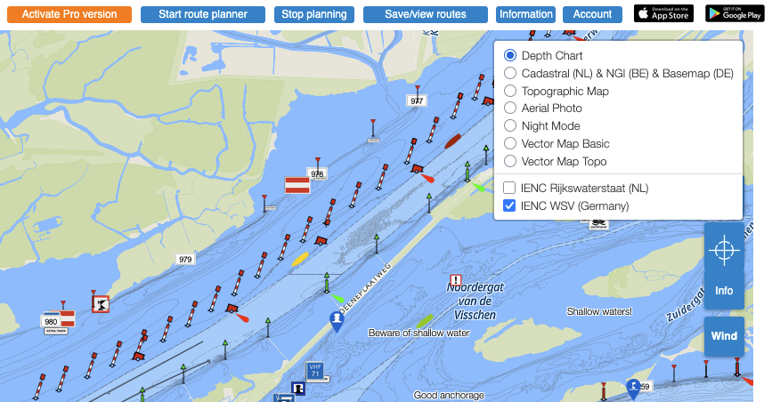
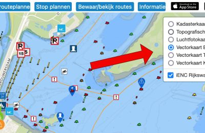
Choose the map layer you want to see and make sure that the 'IENC Rijkswaterstaat' checkbox is checked, after which the IENC layer will automatically be shown everywhere.
In a large part of the Netherlands you see the shipping channel, areas and objects more clearly indicated, but these maps are especially spectacular in Zeeland and in the Wadden Sea, Eems and Dollard. They beautifully show the location of the sandbanks at the different zoom levels and provide a lot of (nautically guaranteed) depth information:
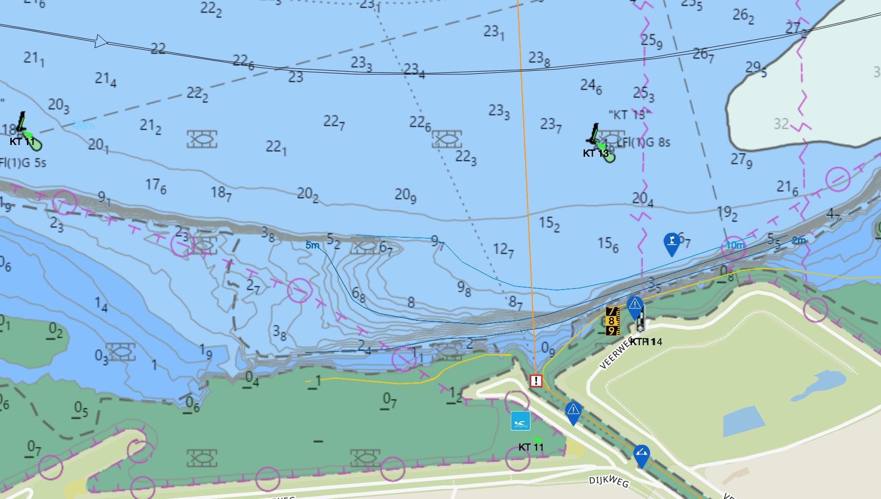
Together with the data from the other map layers, you can compile the most complete water map of the Netherlands that displays exactly the information you need when sailing.
UPDATE April 19, 2023: the depth layer is now integrated into the main map called depth map, the IENC layer now displays the ENCs in their original form. Try it out!
Have fun with watermaplive.net and the Water Map Live apps!