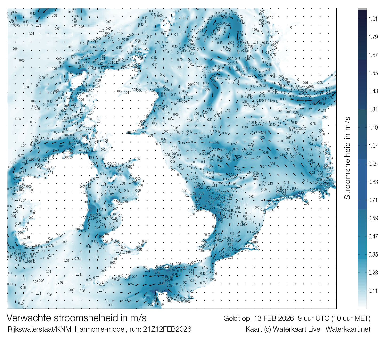
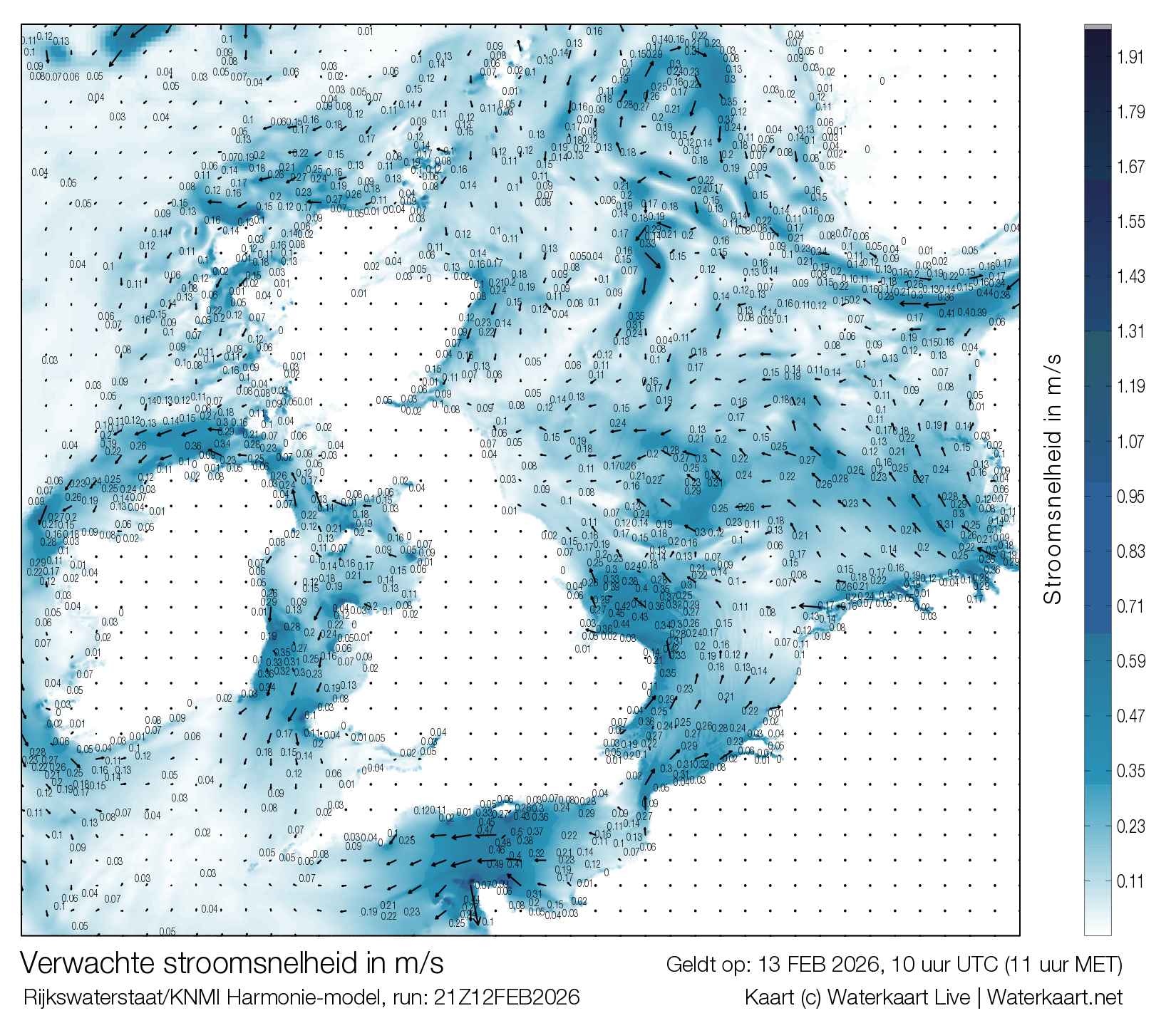
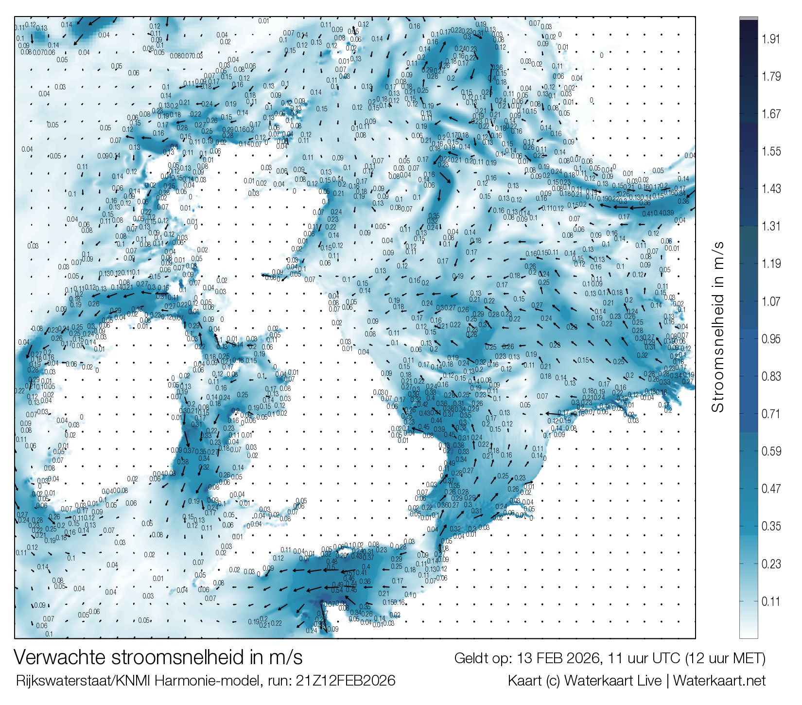
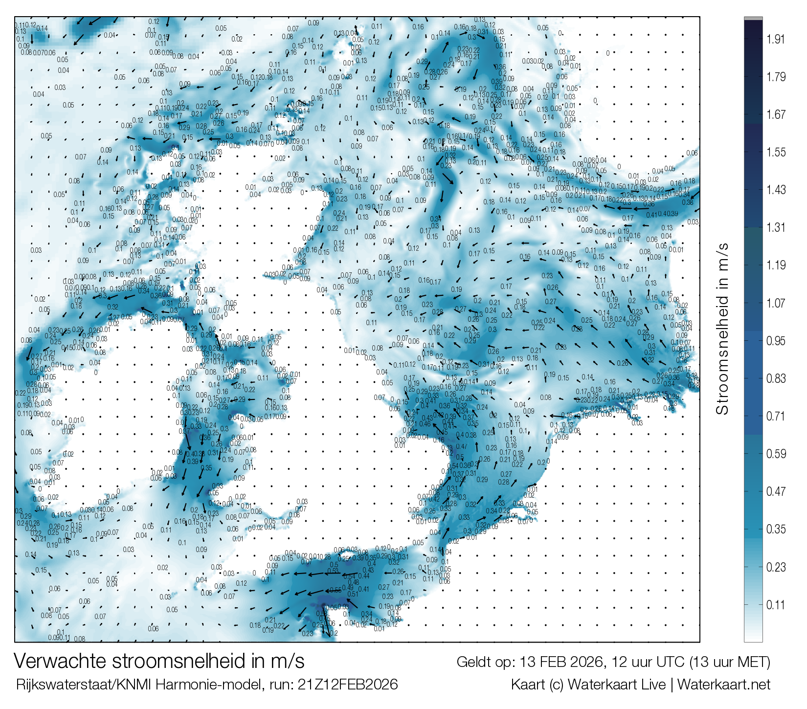
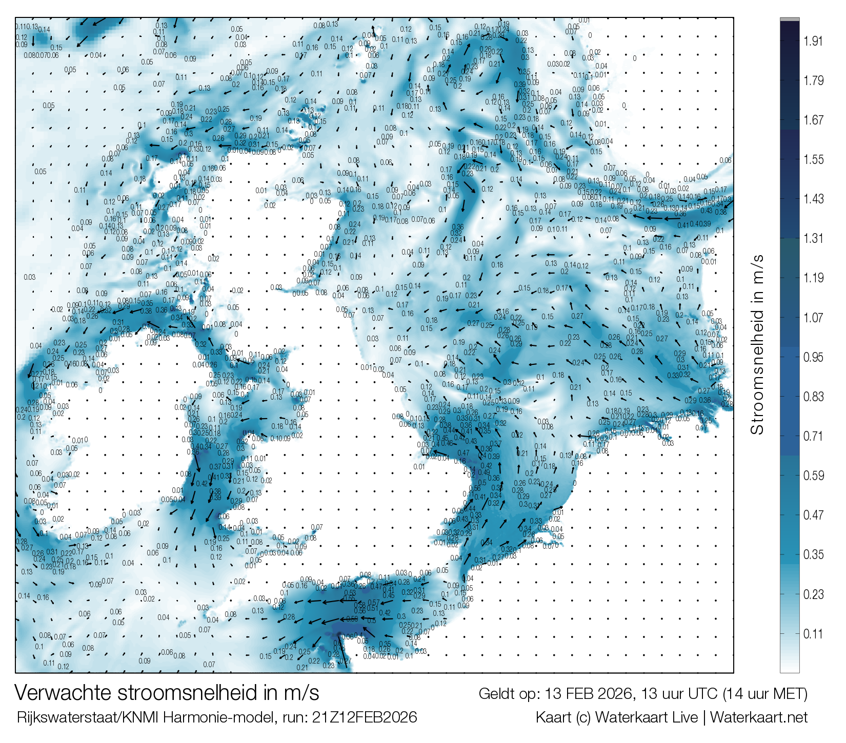
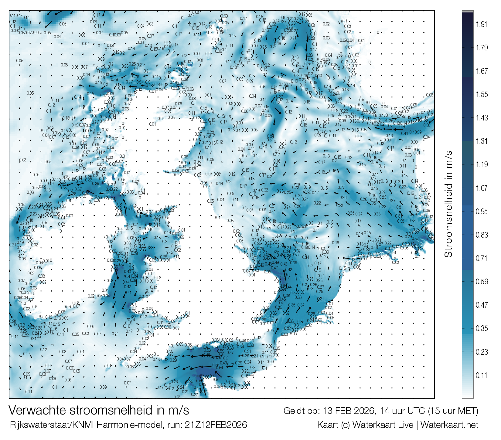
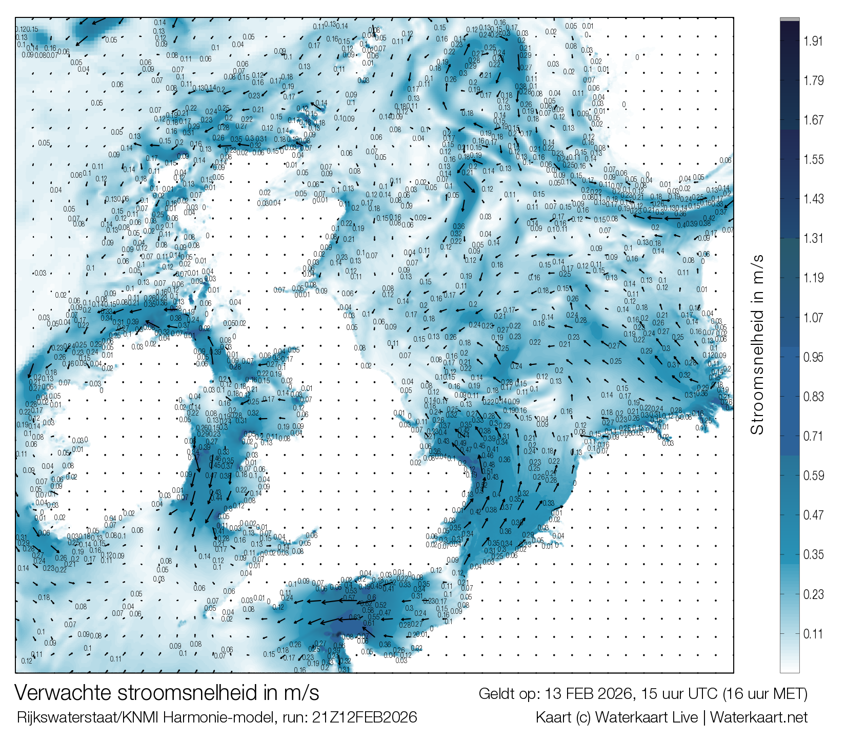
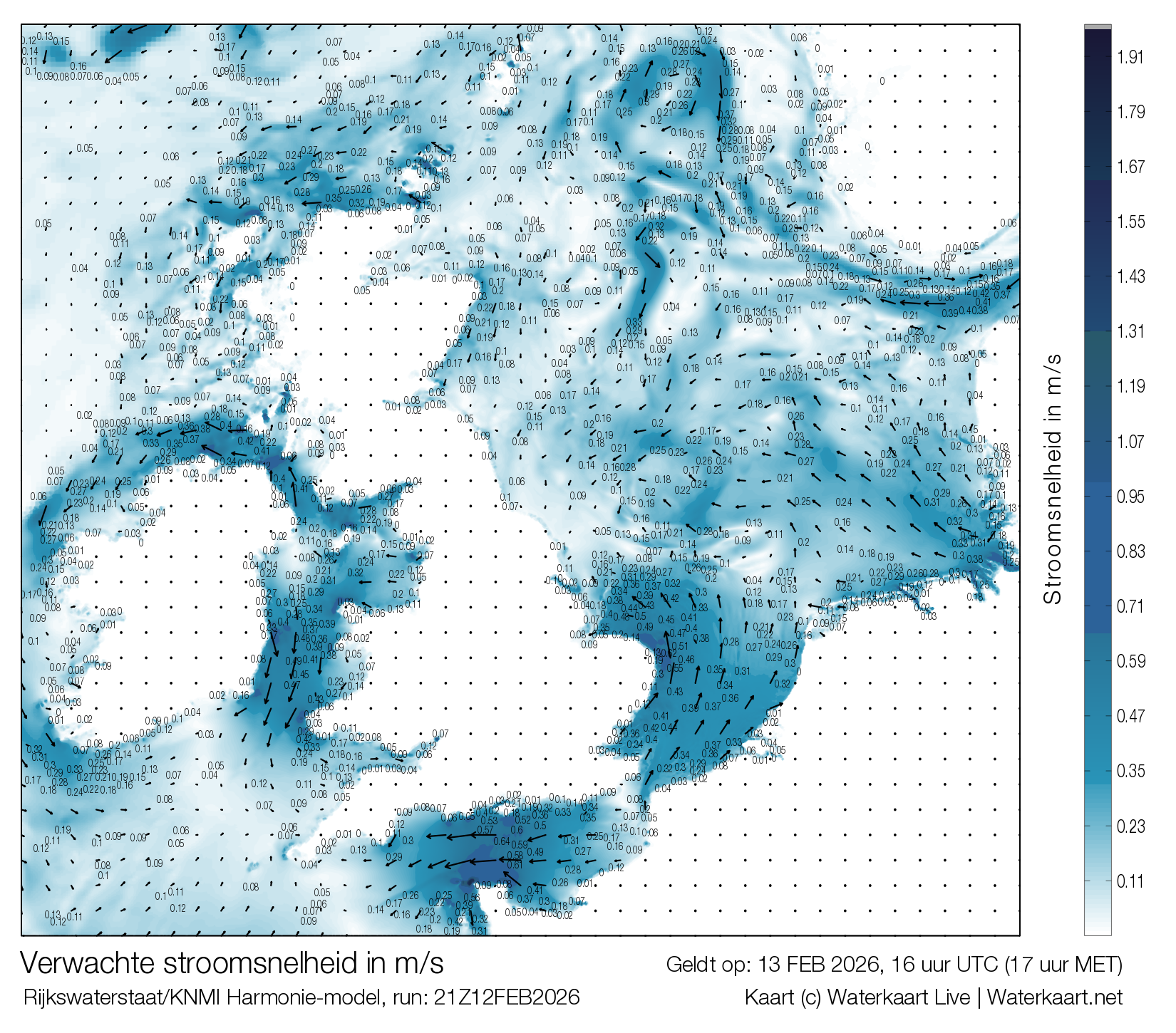
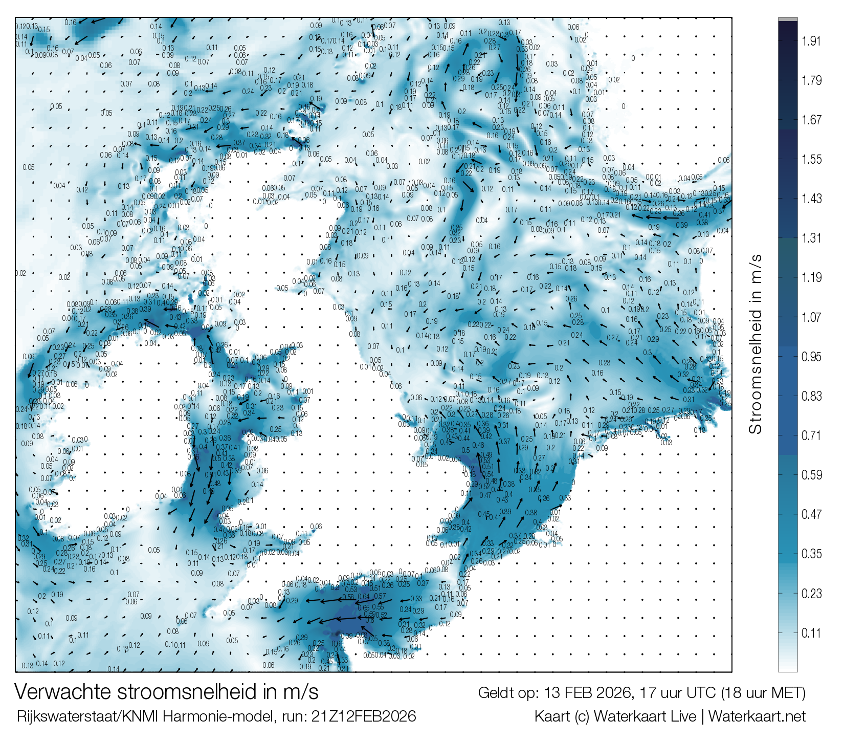
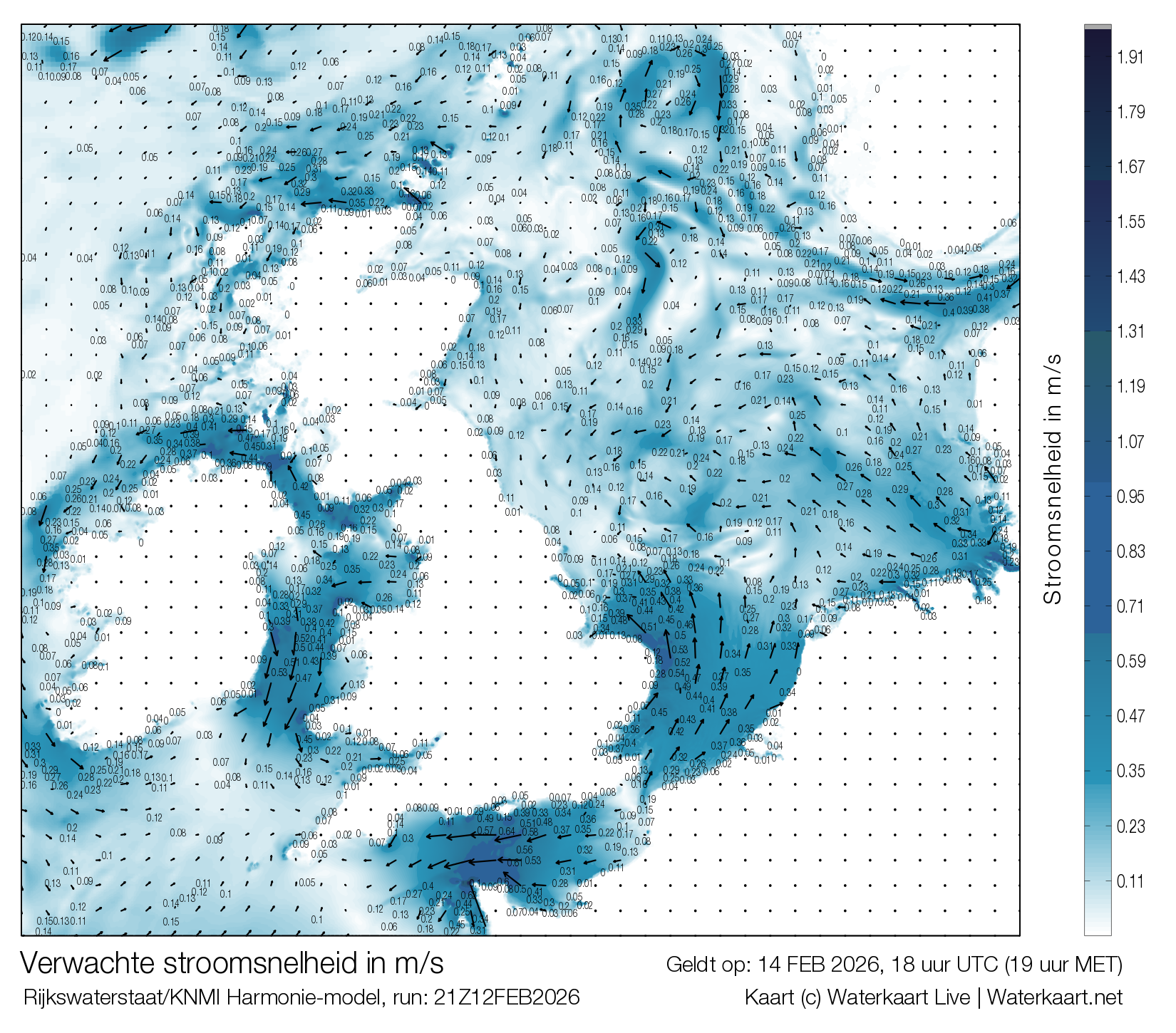
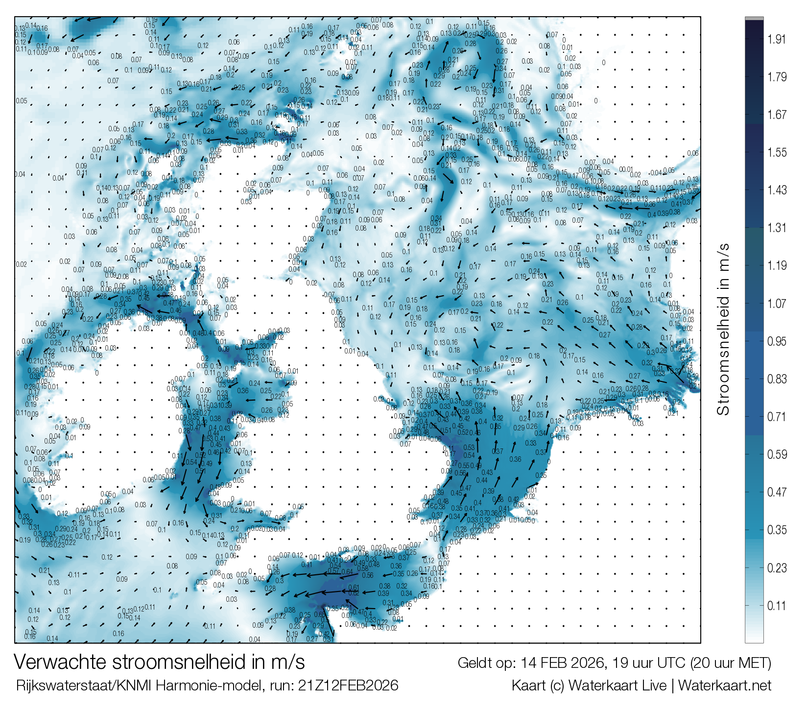
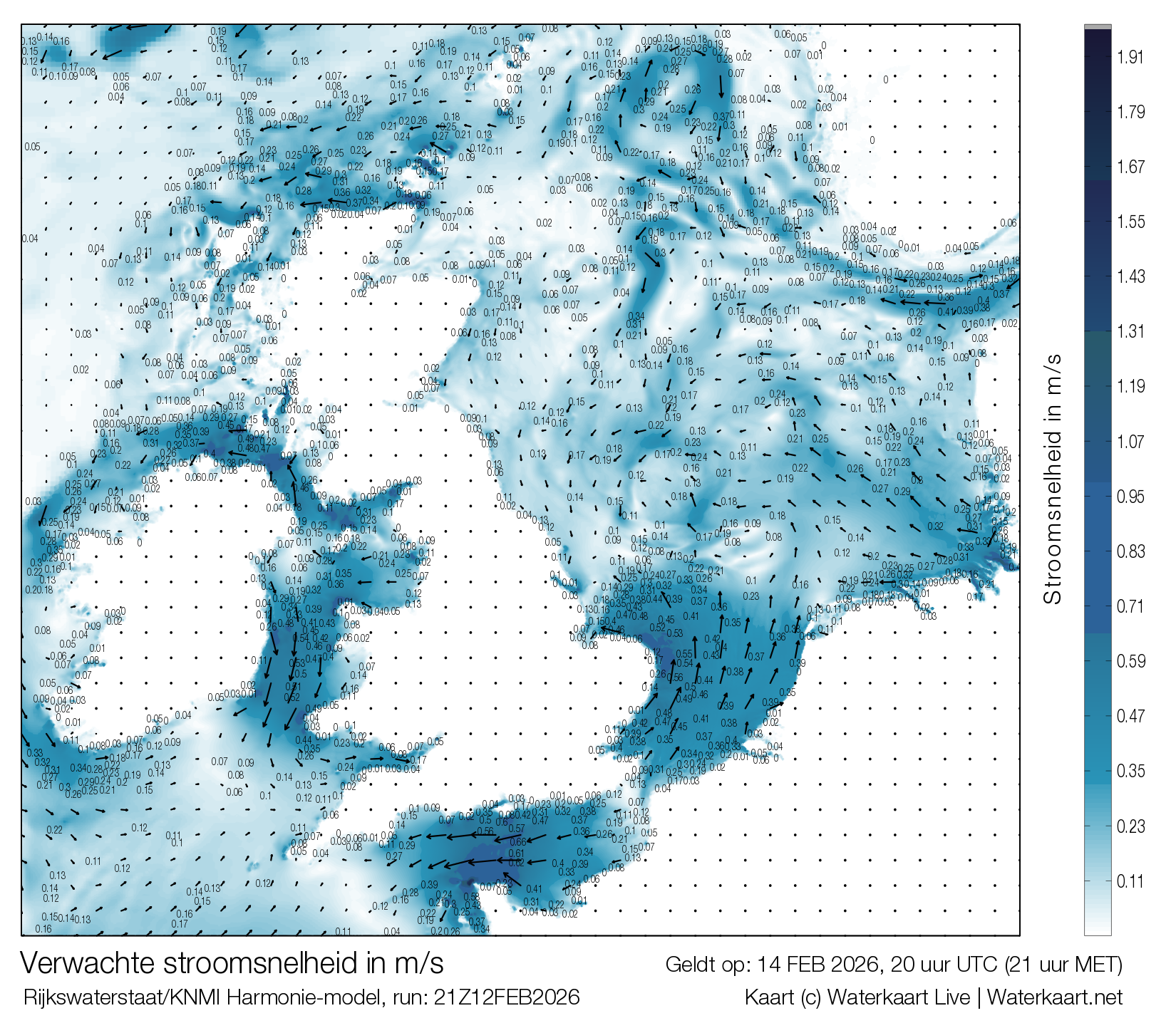
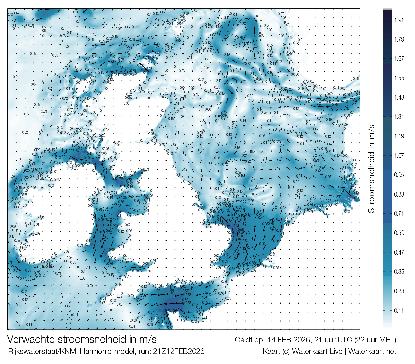
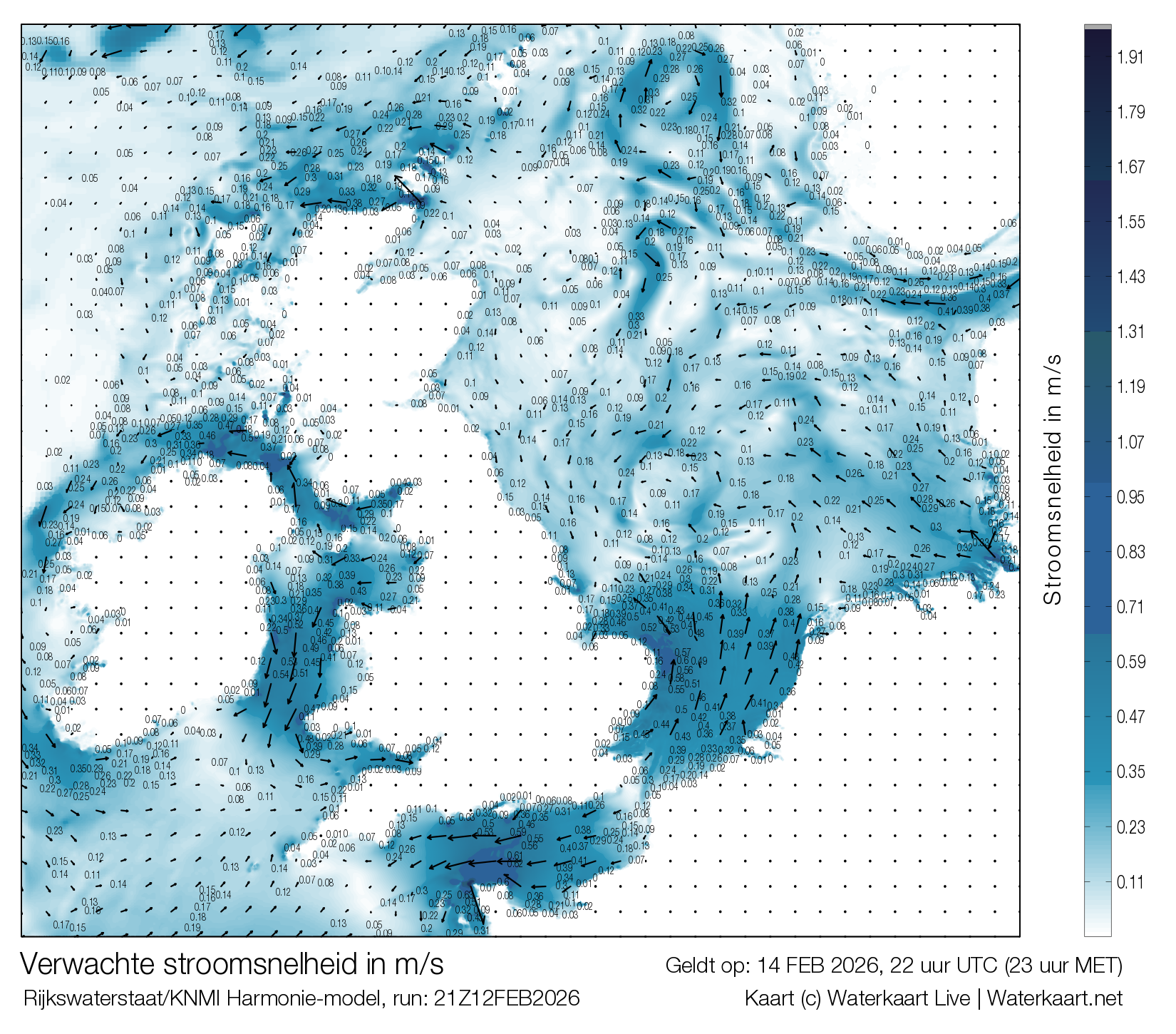
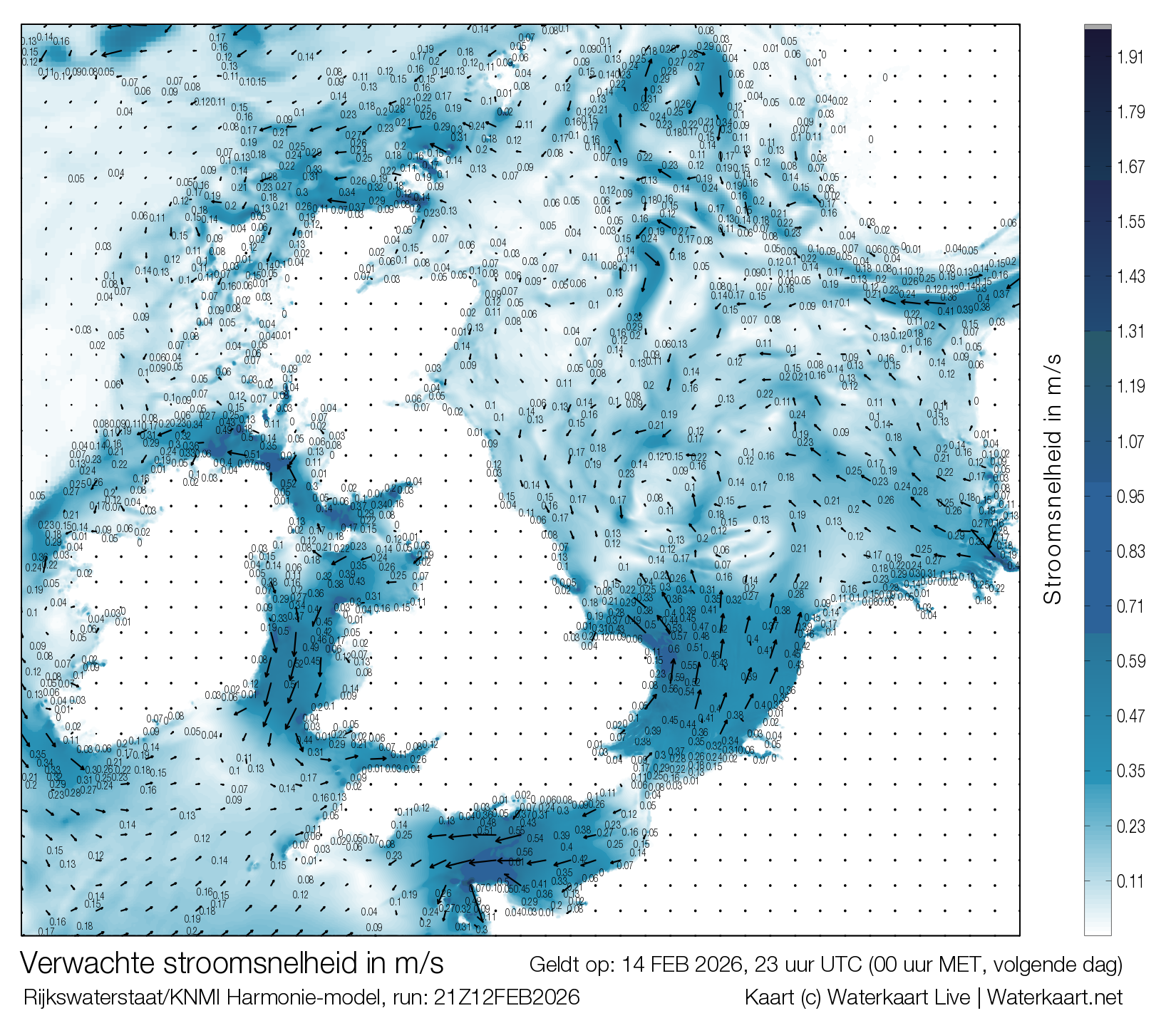
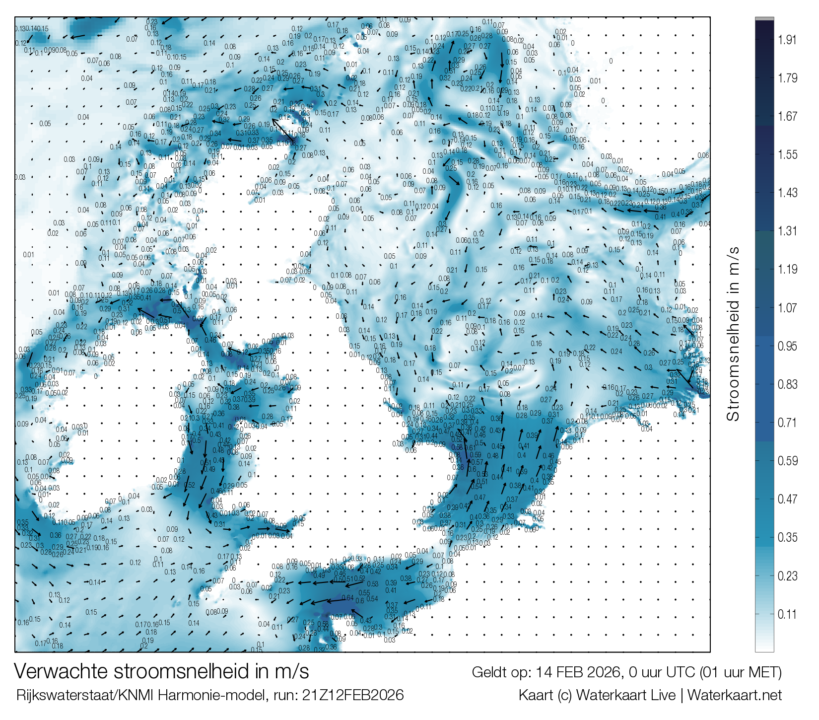
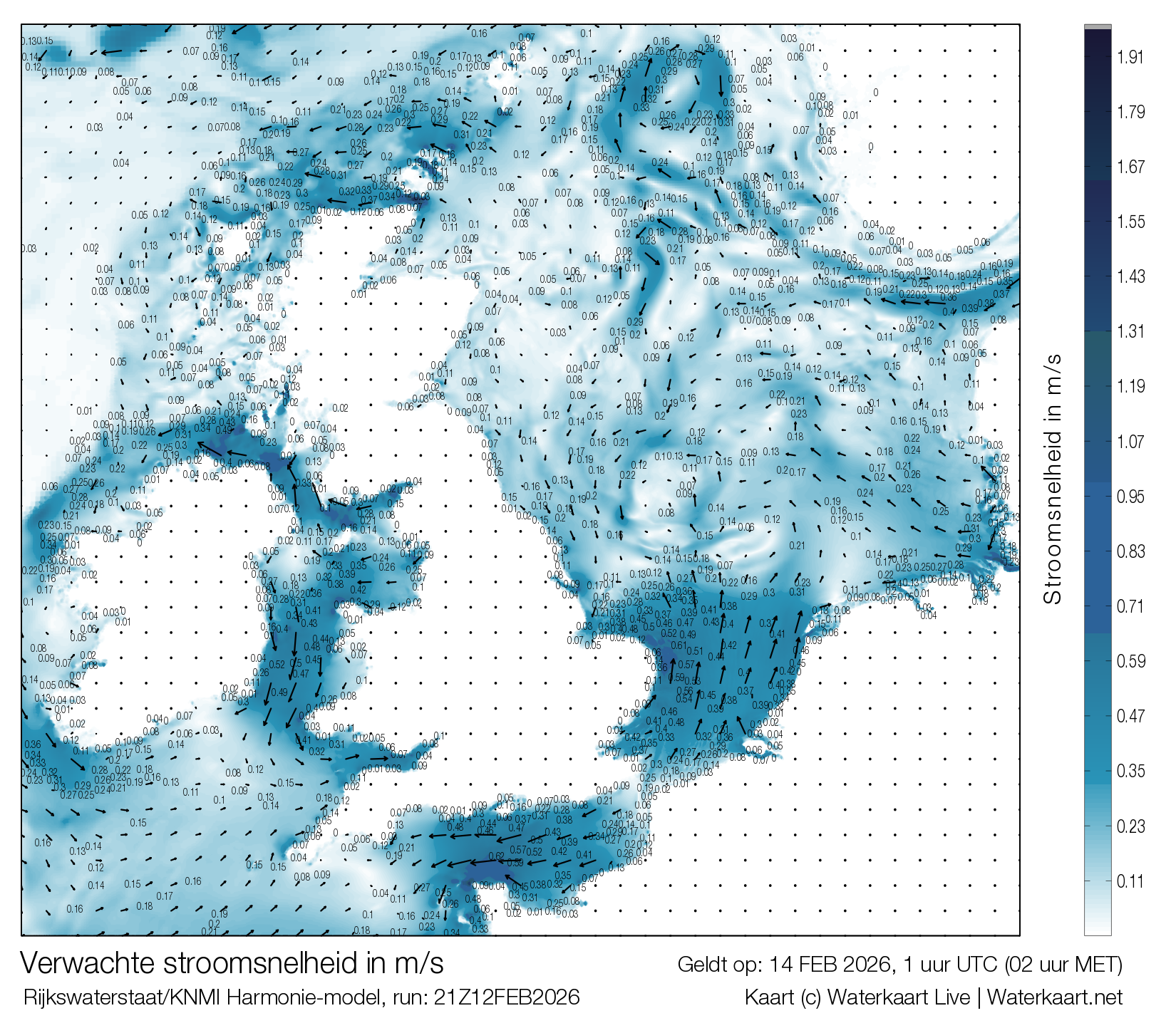
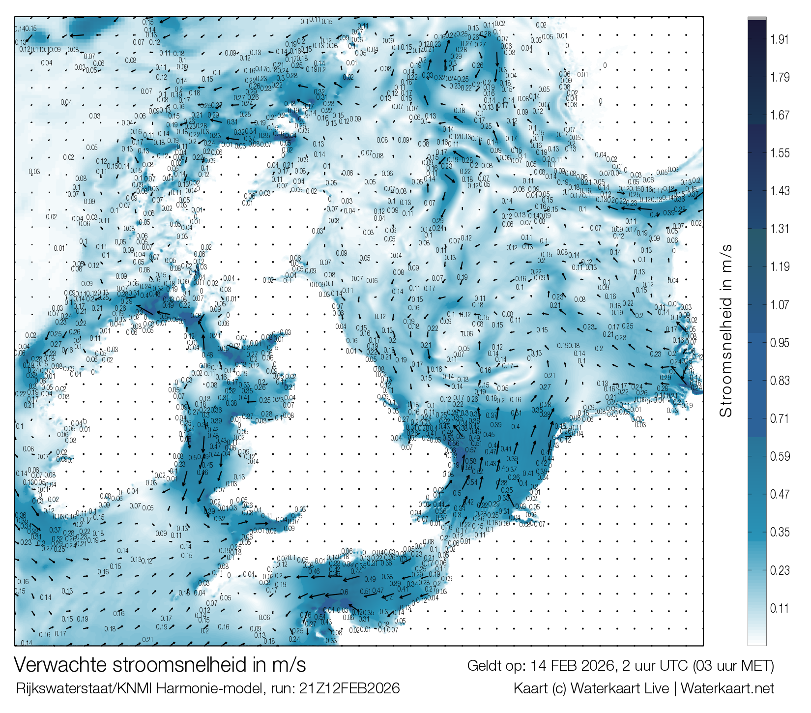
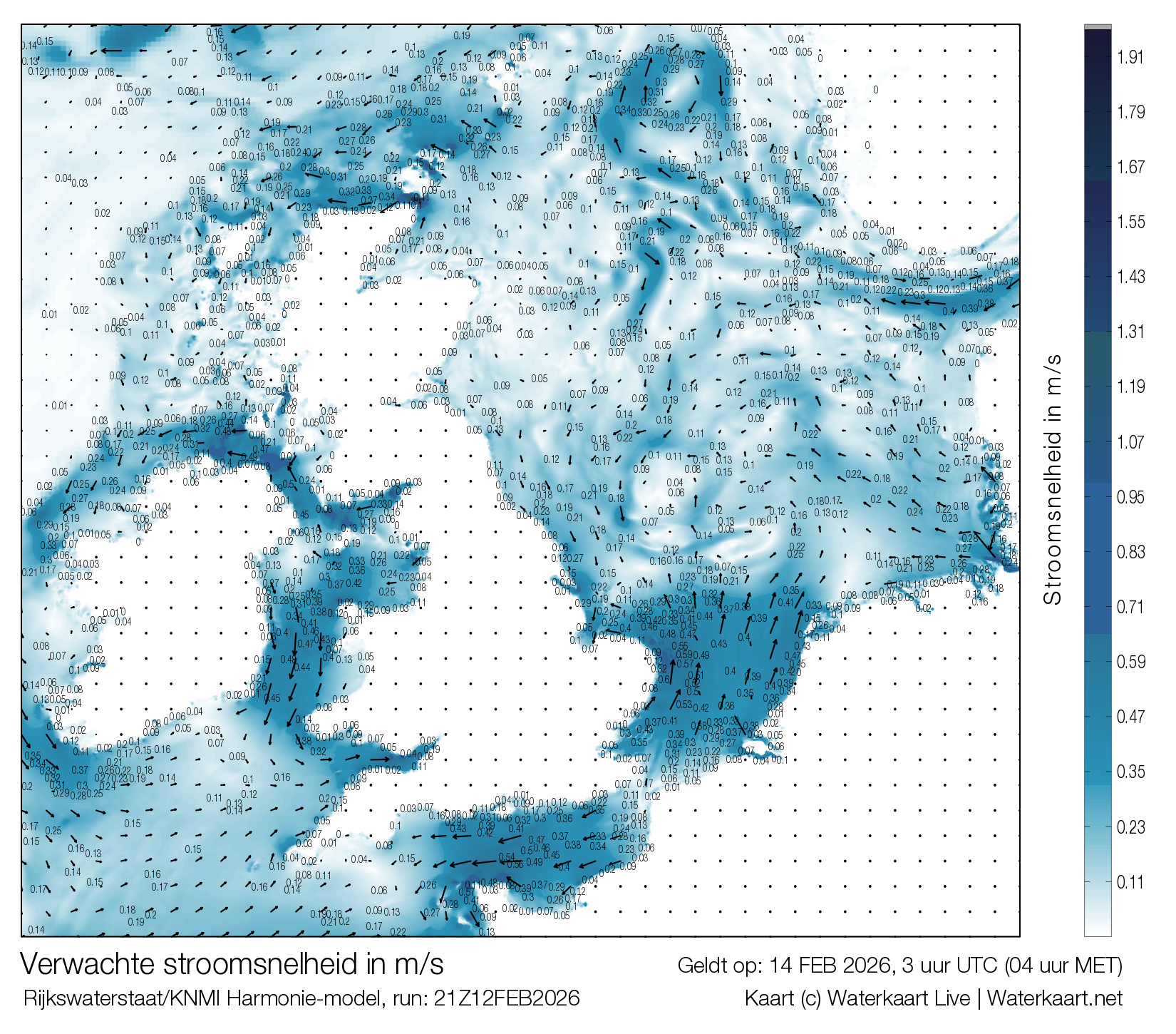
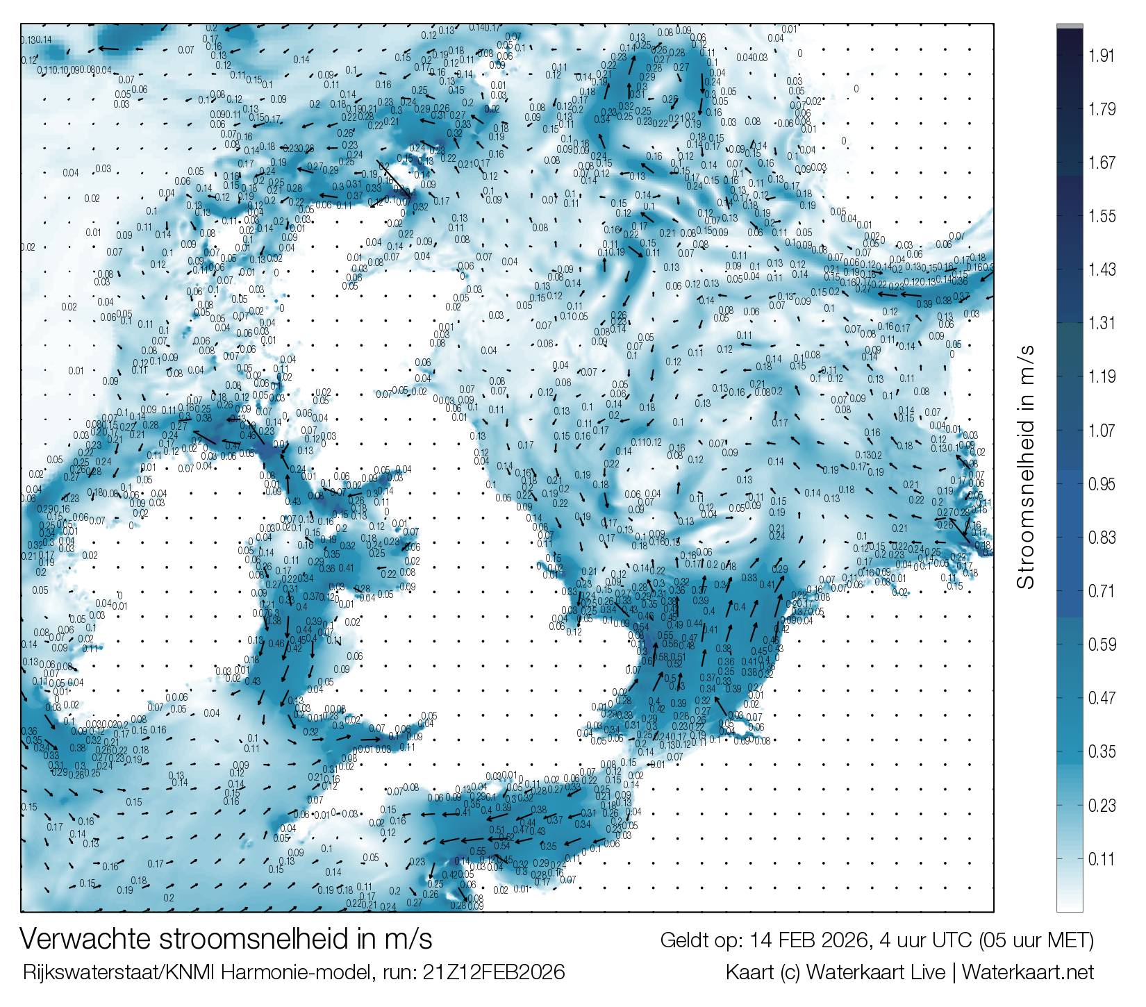
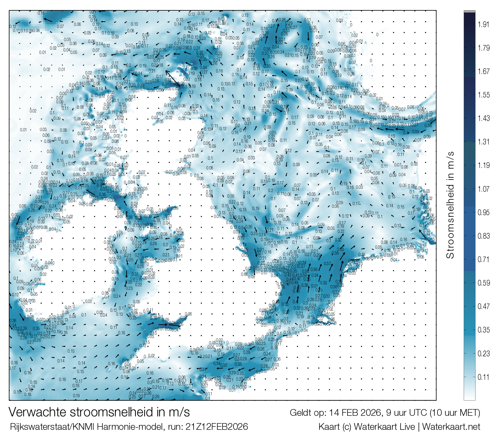
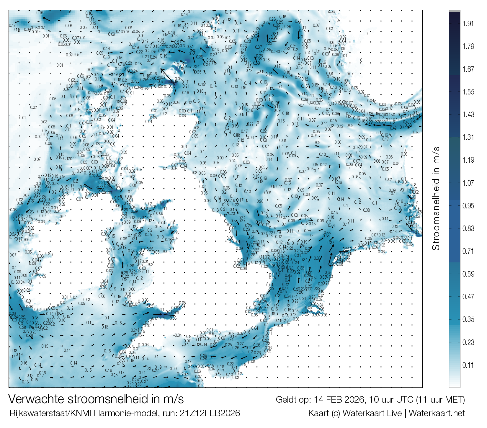
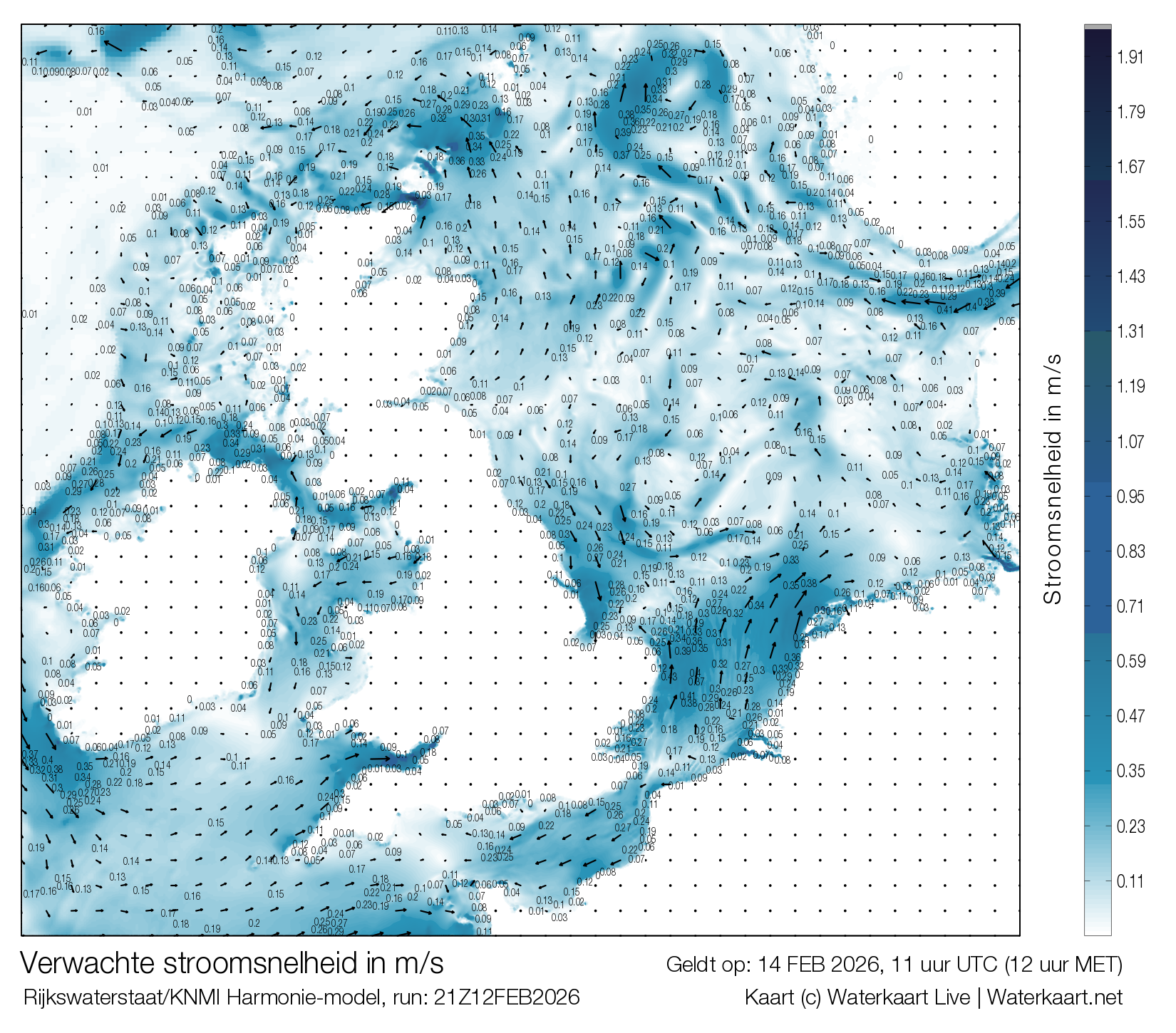
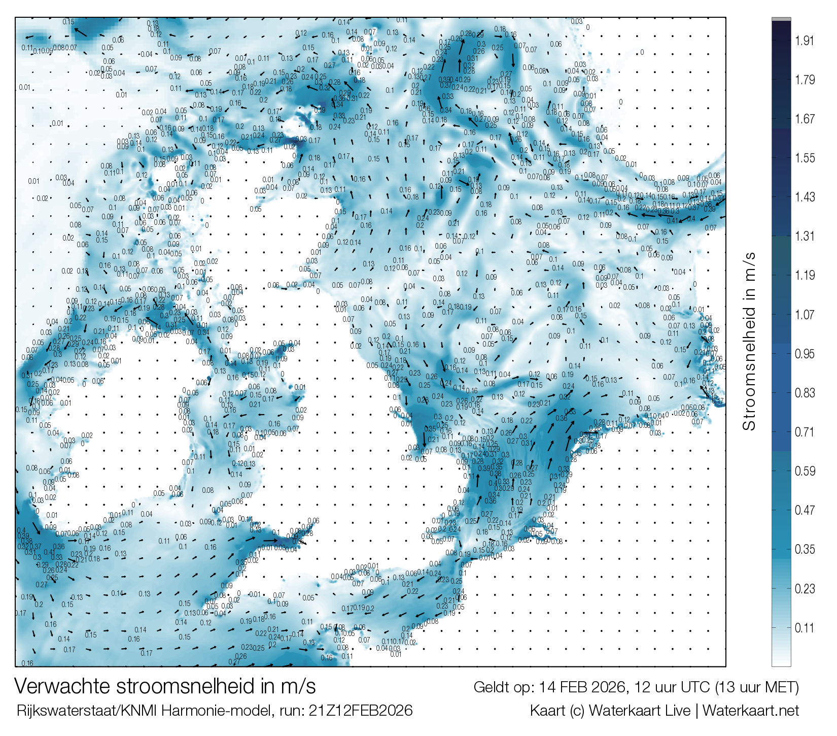
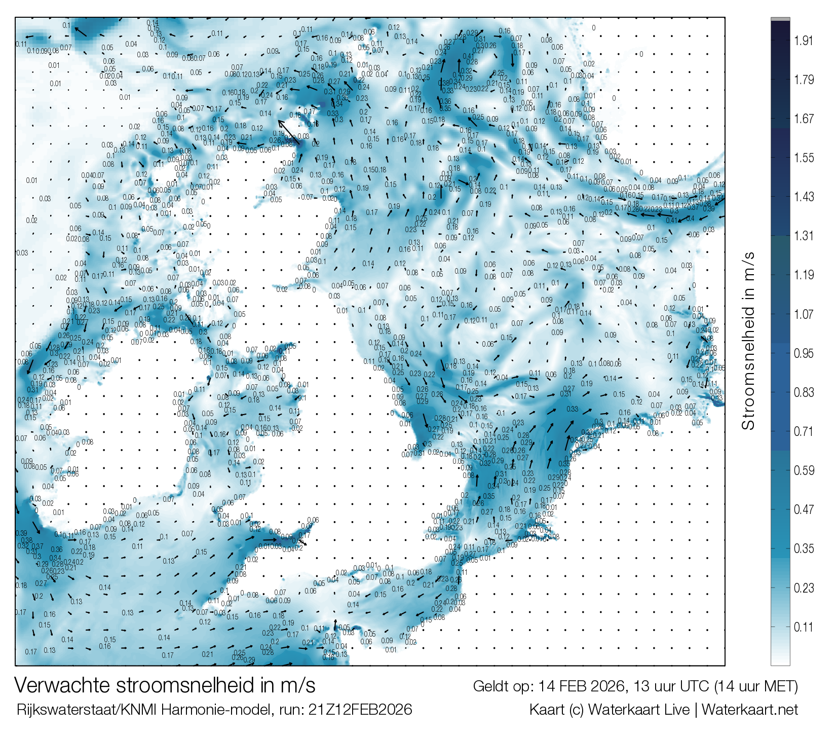
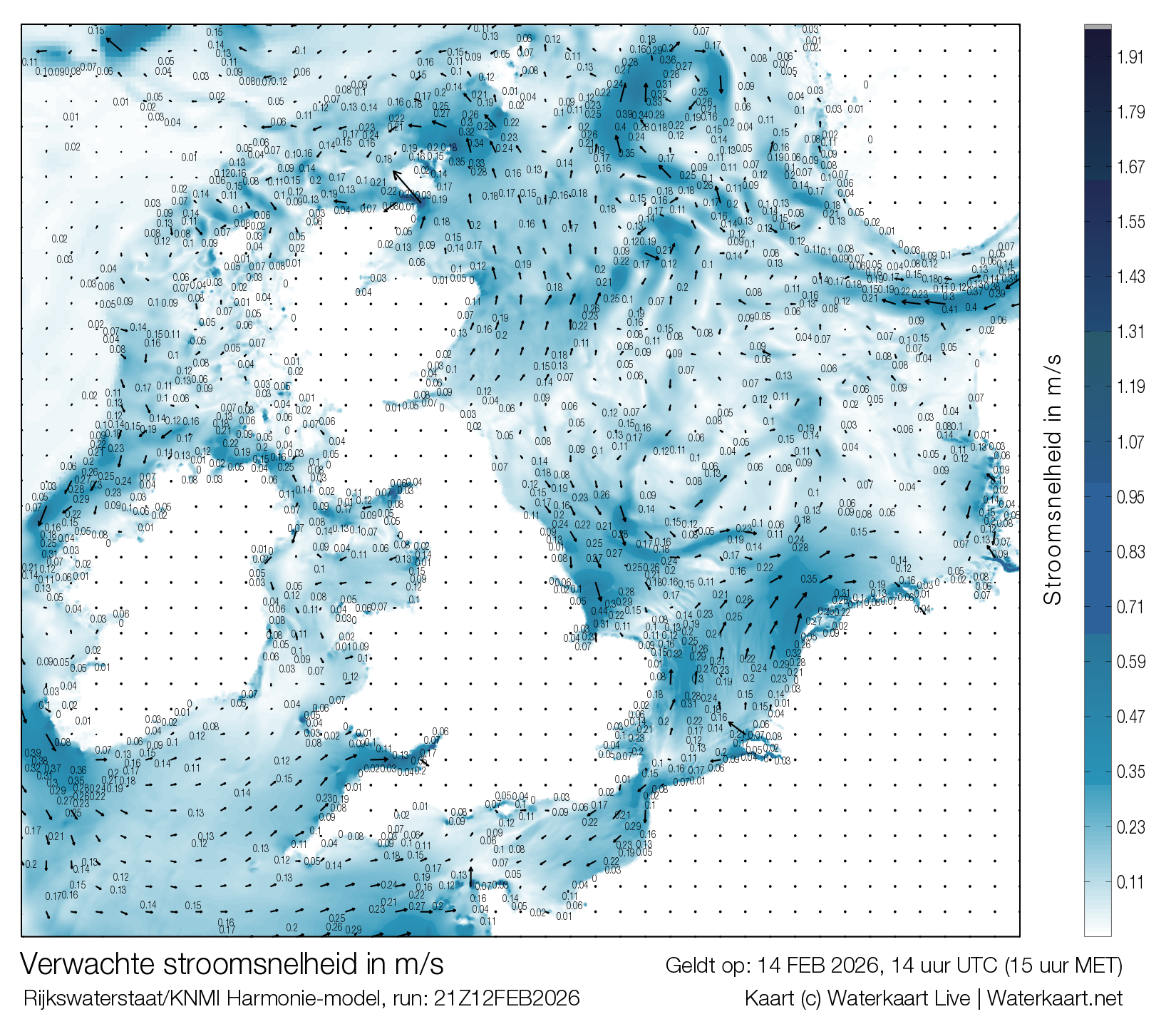
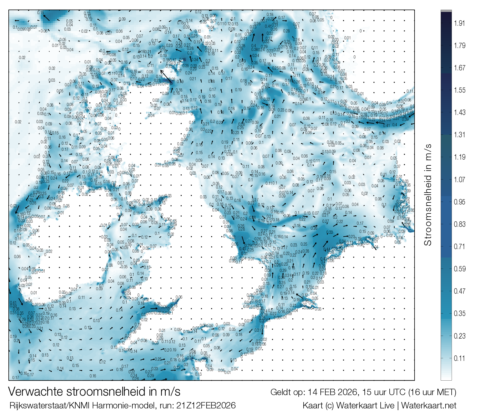
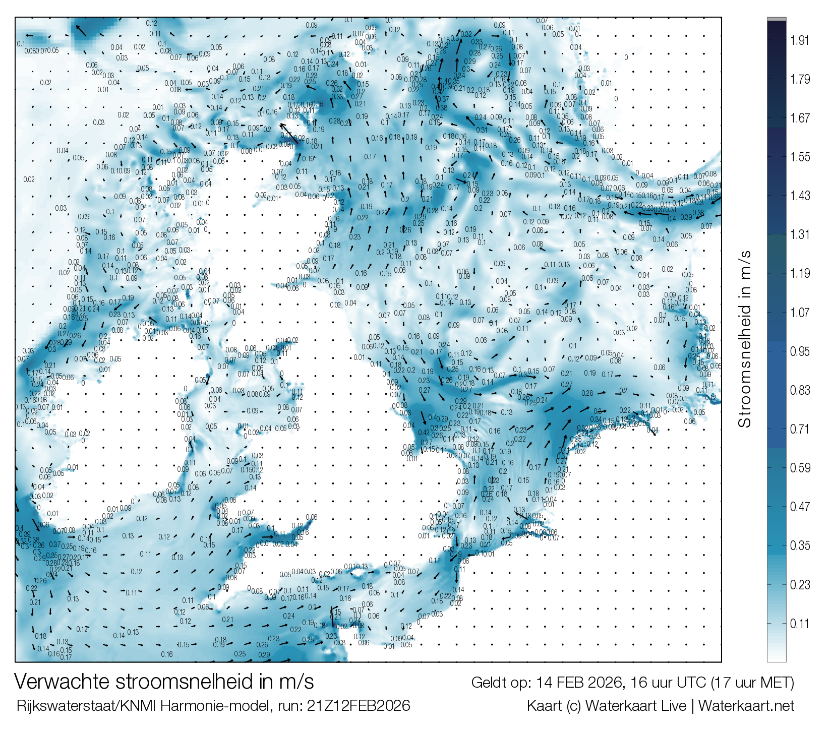
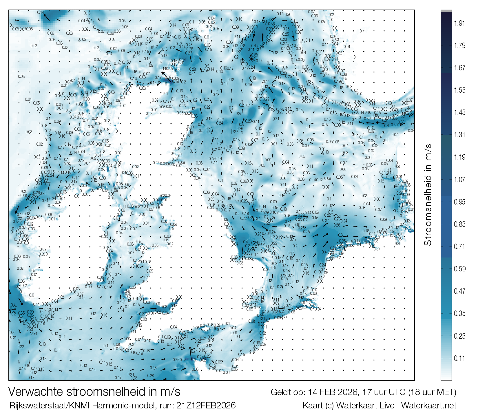
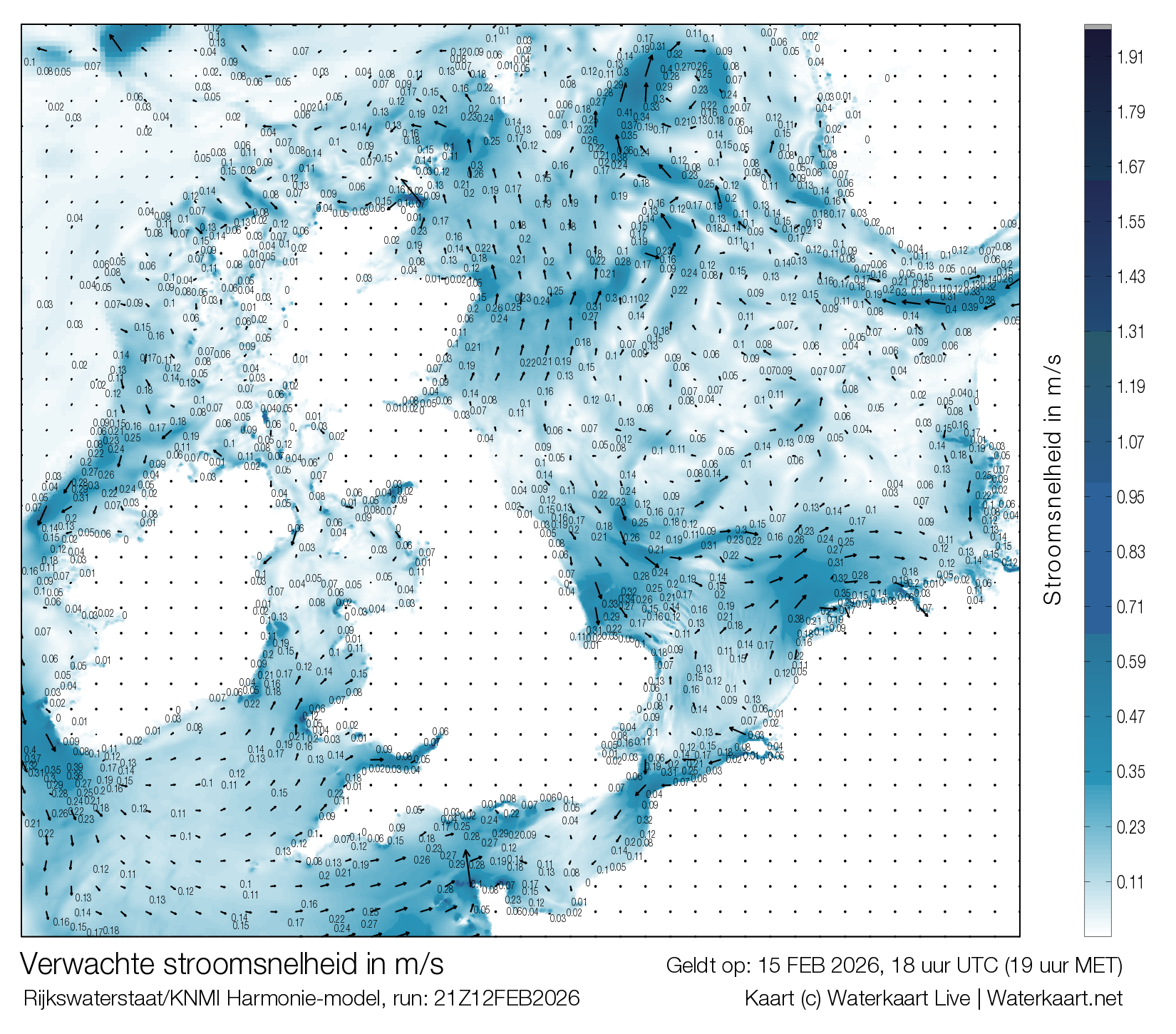
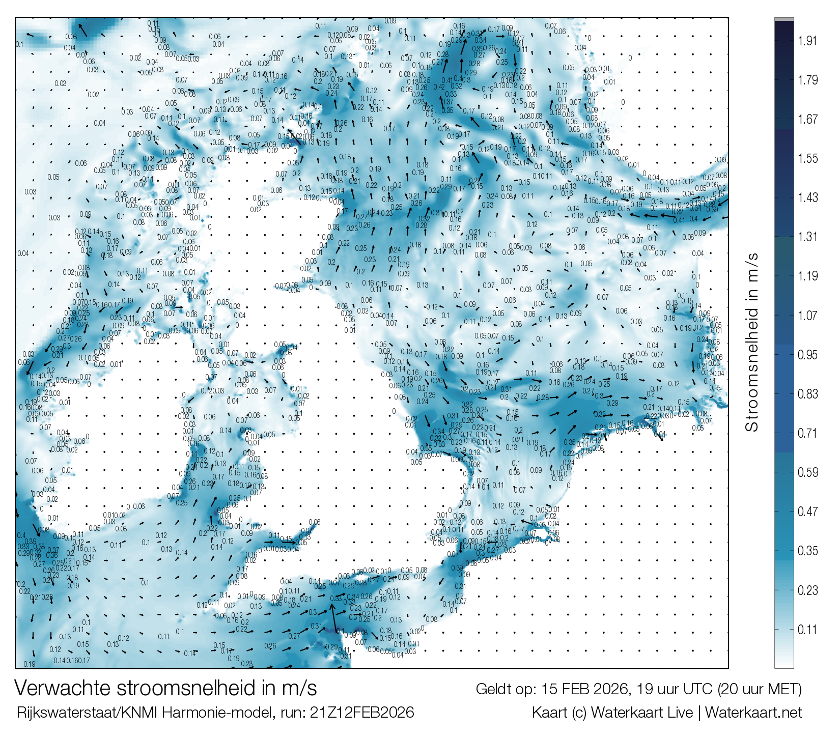
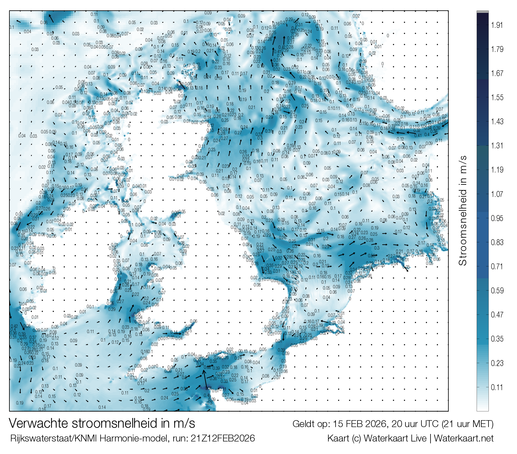
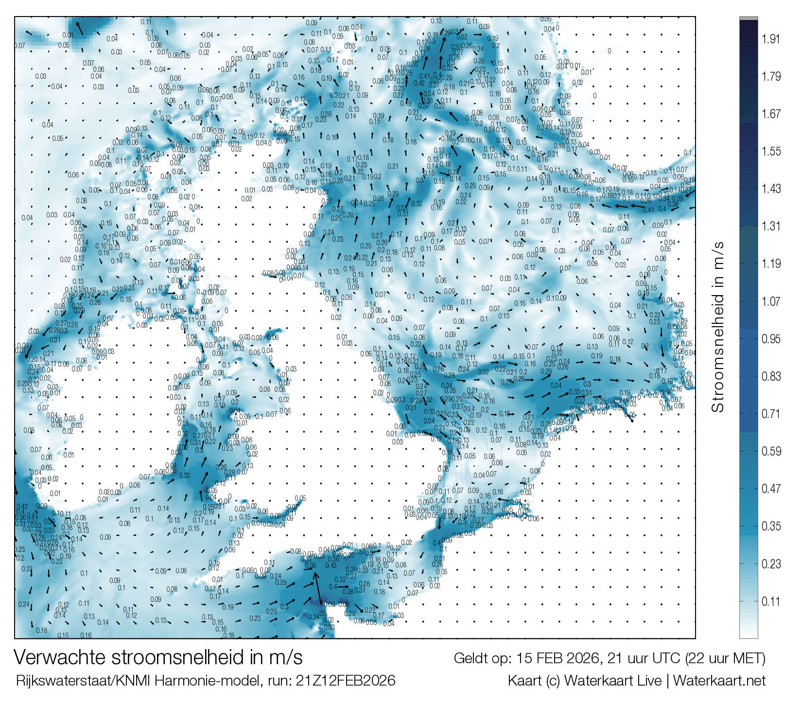
Stroomsnelheid Noordzee in meters per seconde
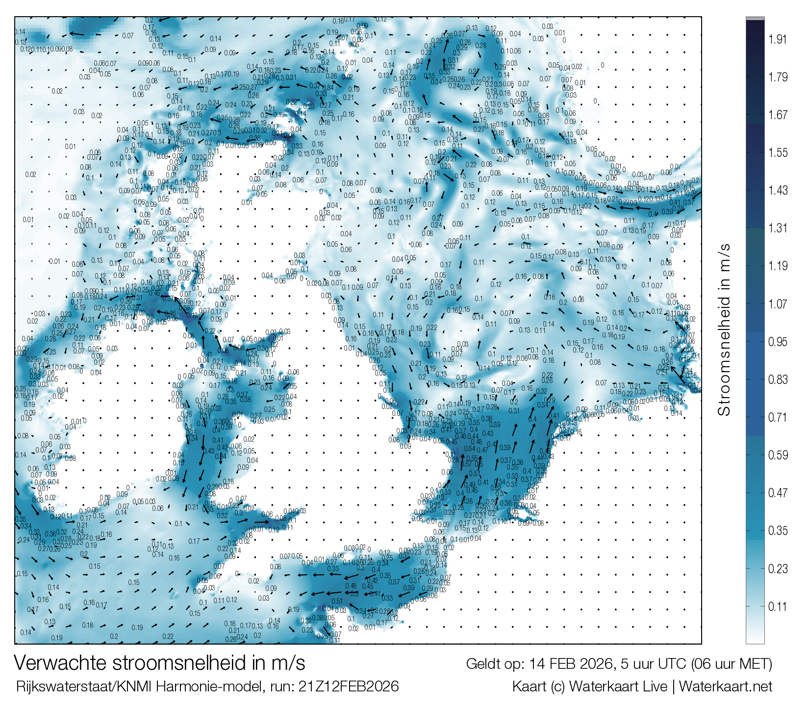
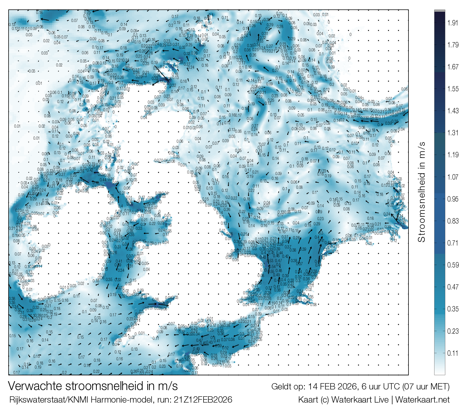
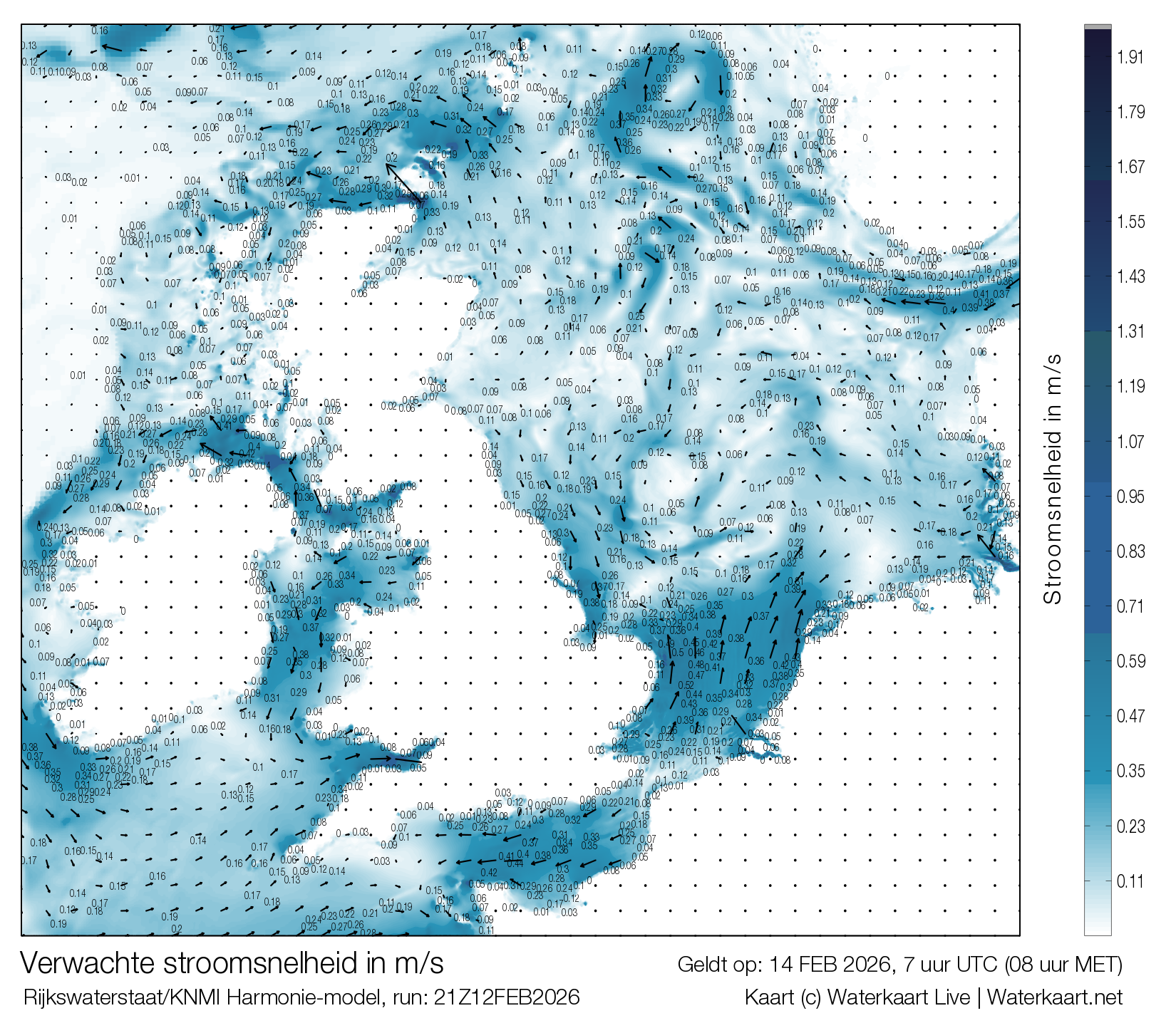
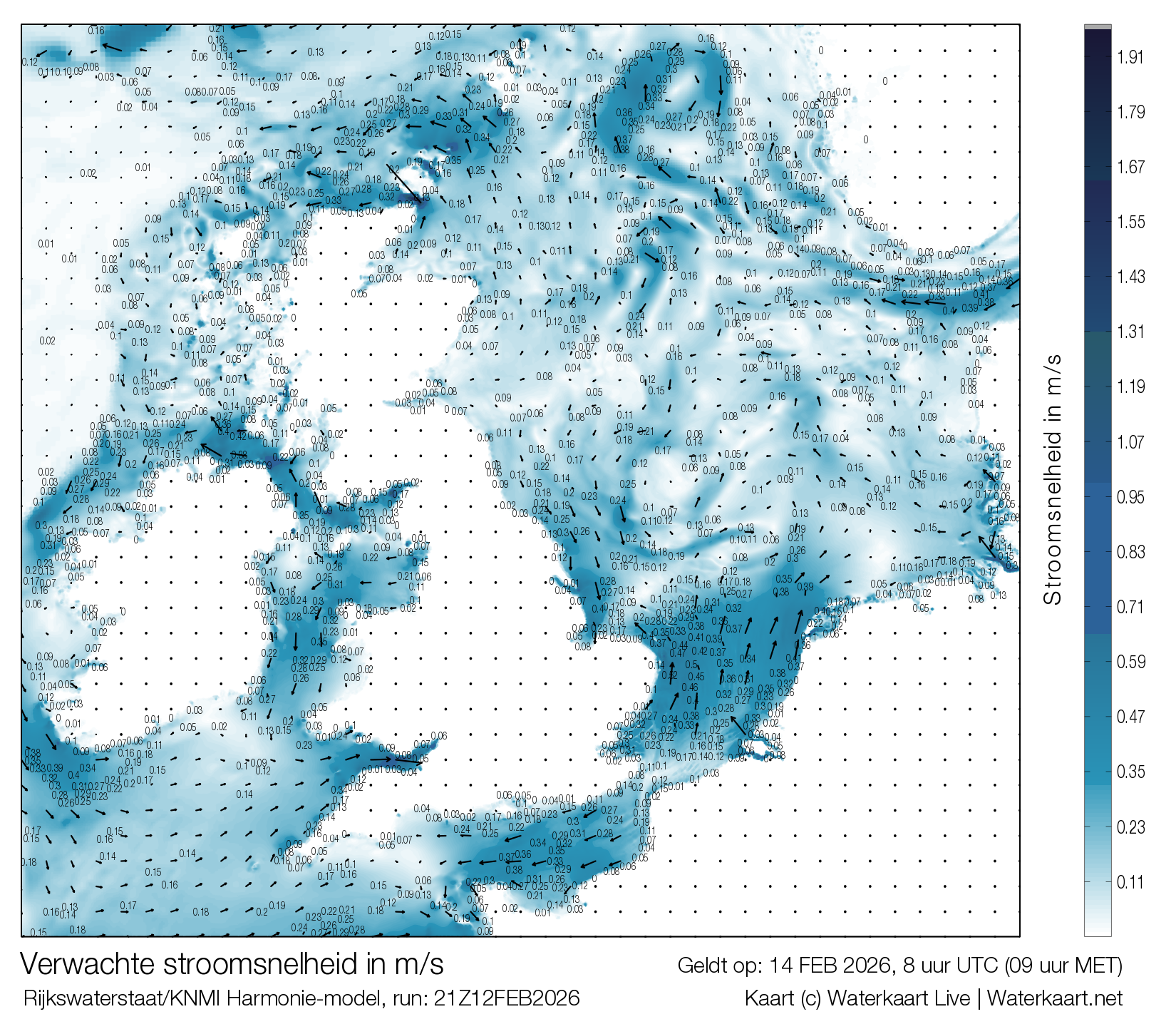
Stroomsnelheden in de Noordzee op basis van de Stroomatlas, verrekend met weersinvloeden. Deze worden iedere dag ververst met data uit het zeestromingen model van Rijkswaterstaat op basis van Harmonie weerdata, voor ieder uur een kaart, tot 48 uur in de toekomst. Lees hieronder meer over dit model
Over deze stroming modelkaarten
De loop van de stromingen in de Noordzee is in grote lijnen bekend en in verwachtingsmodellen opgenomen, deze zijn gedocumenteerd in de bekende HP33 stroomatlas van de Hydrografische dienst van de Koninklijke Marine. En daarmee ook in de Stroomatlas App.
Atmosferische invloeden
Echter is de stroomsnelheid en het verloop van de stromingen ook onderhevig aan - vooral - de luchtdruk, windrichting- en snelheid in de atmosfeer. Deze zijn vanzelfsprekend niet in de golfmodellen meegenomen. Om dit hiaat op te vullen heeft Rijkswaterstaat een stroming model ontwikkeld waarin het de verwachte invloed van de atmosfeer laat inlopen.
Dagelijks bijgewerkt
De dagelijkse output van dit model vind je op deze pagina in de vorm van deze stromingkaarten. Deze worden iedere nacht door onze servers opgehaald en verwerkt en gelden voor de 48 uur na het rekenmoment van dit model (de runtijd, zoals onder iedere afbeelding weergegeven). De tijd van iedere kaart is weergegeven in UTC, deze ligt twee uur voor op de Nederlandse tijd, welke tussen haakjes is weergegeven.
Windverwachting
Nederland
Windverwachting knopen
Windverwachting Beaufort
Windverwachting + luchtdruk
Waddenzee
Windverwachting knopen
Windverwachting Beaufort
Windverwachting + luchtdruk
IJsselmeer en Friese Meren
Windverwachting knopen
Windverwachting Beaufort
Windverwachting + luchtdruk
Zeeland
Windverwachting knopen
Windverwachting Beaufort
Windverwachting + luchtdruk
Weerkaarten
HiRLAM analyse
DWD ICON verwachting
ECMWF 850 hPa
Actueel satellietbeeld
Synoptische analyse KNMI
Pluimen Nederland
Download de stroomatlas app
Met de Stroomatlas app heb je altijd en overal de stroomgegevens van de Noordzee, Wadden en Zeeuwse wateren bij de hand. Deze bevat alle kaarten van de HP33, overzichtelijk op je telefoon of tablet, samen met de live waterstanden van de relevante referentiestations.
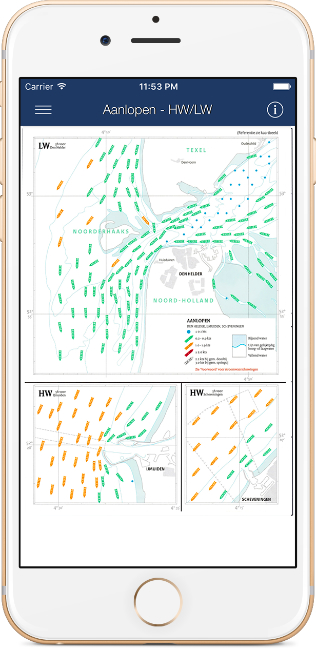
Download de app voor iOS of Android.
