New: Connect your AIS transponder to Water Map Live for live vessel positions
It is now possible to connect your boat's AIS transponder or multiplexer to Water Map Live. This gives you a clear, real-time overview of vessel positions around you. Do you also have GPS in your on-board network? The app will use that as well. Pairing through the app is very straightforward. Read on to find out how to set it up.
Dutch Version
🇳🇱 | German version 🇩🇪
The Automatic Identification System (AIS) was developed to improve safety on the water, and its adoption has grown tremendously in recent years. This makes total sense: with a transponder on board, you can not only see other vessels, but they are also constantly kept up to date with your position and movement.
You can now connect the Water Map Live app directly to your transponder via built-in Wi-Fi, or through your local network if you have an on-board system. The in-app scan feature automatically searches for your AIS hardware, and within seconds vessel positions will start streaming onto your screen. Here is how to do it:
Step 1: Start the AIS feature
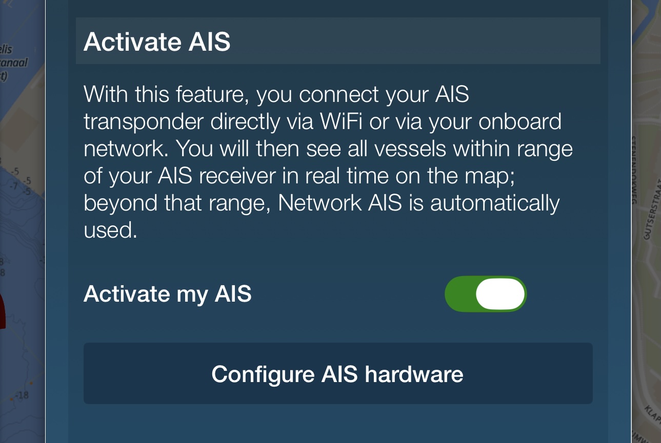
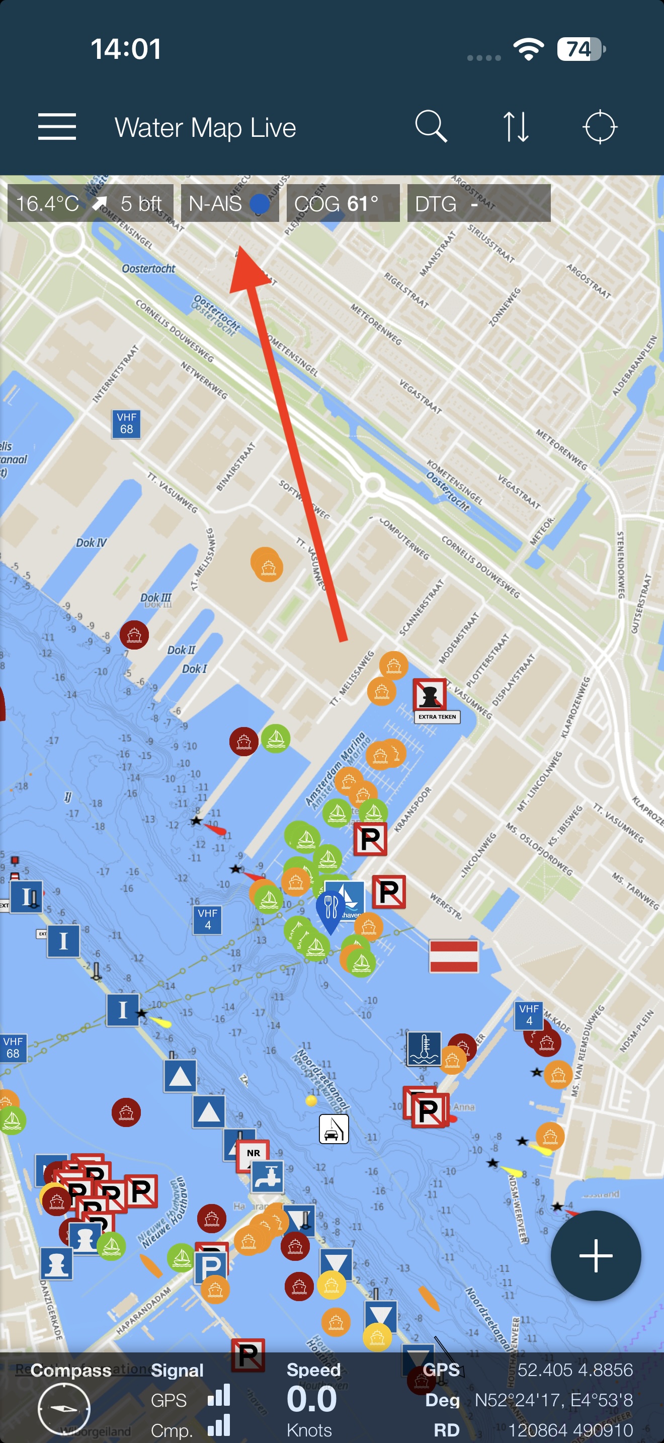 You launch the AIS feature directly from the Water Map Live app. On the main screen, look at the top centre for the N-AIS monitor: tap it, and a menu will appear allowing you to configure both AIS and Network AIS. (To clarify: AIS refers to connecting your own transponder for a real-time view of your immediate surroundings, whereas Network AIS fetches vessel positions with a slight delay from across Europe via the internet. Enabling AIS also activates Network AIS, allowing you to see ship positions beyond the range of your own receiver.)
Directly received AIS positions naturally always take priority over Network AIS.
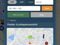
In the window that opens, tap the 'Configure AIS hardware' button.
Step 2: Scan and start
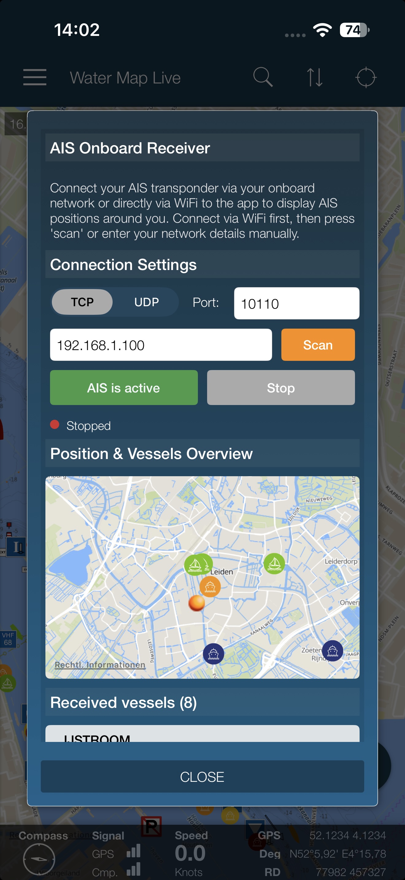 From here it is very simple, as the app includes a built-in discovery function. Make sure your device is connected to the same network as your transponder first. If you have a standalone Wi-Fi transponder, connect your phone or tablet directly to the transponder's Wi-Fi network. If you have an on-board network, connect your device to that network.
All set? Tap the 'Scan' button and wait a brief moment while Water Map Live scans your entire network for AIS hardware. The first detected device (technically: the first usable data stream) is automatically paired in the app. Prefer entering the network address and port manually? You can enter them straight into the text fields. Then, skip the scan button and tap the green button directly. In almost all cases you will want to use TCP; if you need UDP, you likely already know.
That's it! The detected transponder or multiplexer is saved automatically, and you will see vessels appearing on the small preview map. You can close this window now. From now on, whenever the app connects to your on-board network, it will automatically link with your AIS receiver and display the data on the main Water Map Live map.
Step 3: Keep offline data in mind
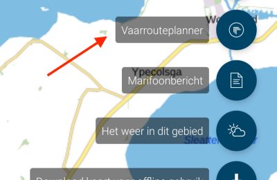
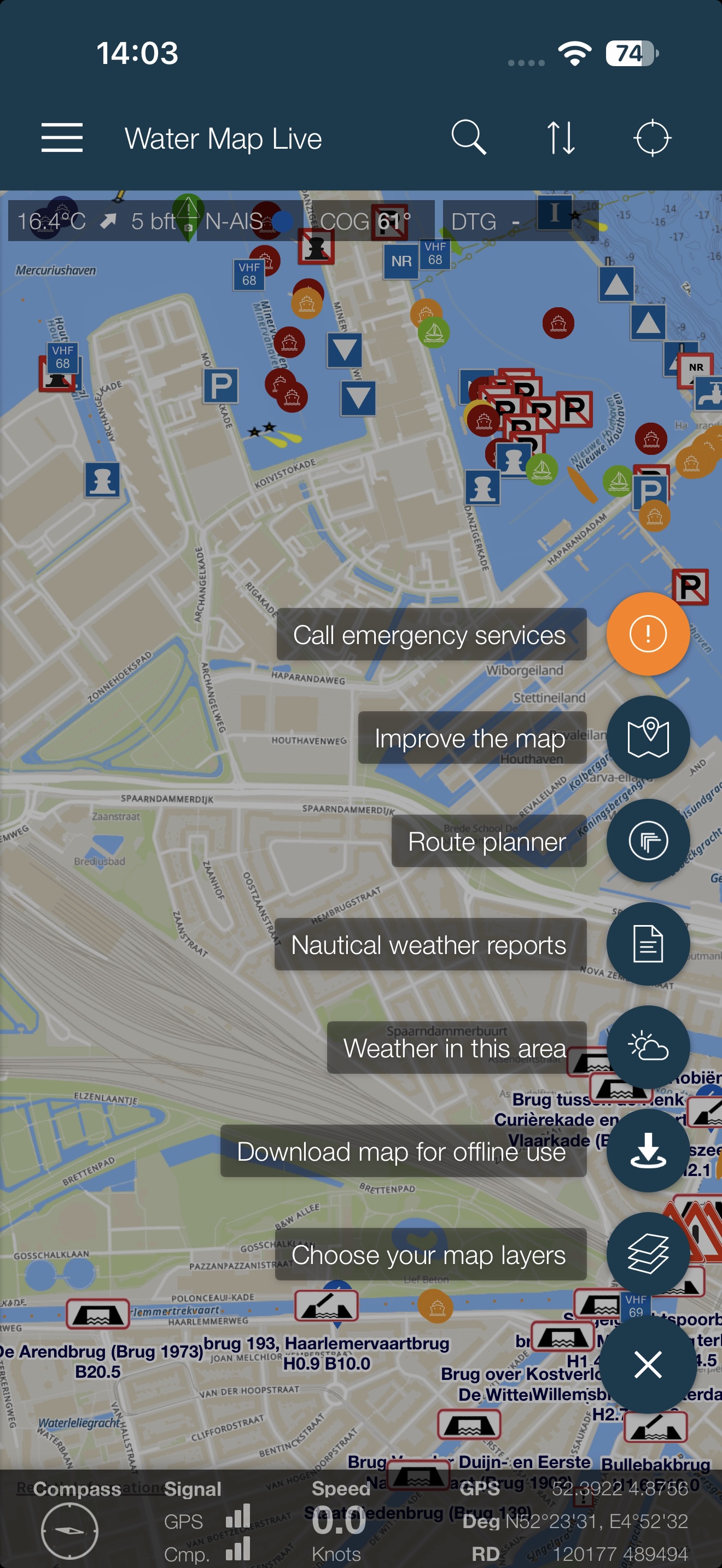 If you have an on-board network with an active internet connection, you can skip this step. However, especially when connecting directly via Wi-Fi to your transponder (which provides no internet access of its own), the app will no longer have an internet connection. To avoid any issues, it is smart to download the map of your cruising area in advance. Tap the round blue button in the bottom right corner and select 'Download map for offline use'.
Once done, you are ready to go. On Android, the app ensures that—even when your device is connected to your transponder via Wi-Fi—it can still retrieve external live waterways data over 4G/5G. And if that is unavailable? Bridge and lock information, marinas, and swimming water quality remain fully accessible offline. On iOS (iPhone), make sure that 'Wi-Fi Assist' is turned on in your device settings (the grey gear icon app). This is typically enabled by default, but it never hurts to double-check.
In short: download your map for offline use and you're good to set sail!
Frequently Asked Questions
1. No vessels visible with UDP or TCP?
Check whether you are connected to the boat's Wi-Fi network. For UDP, make sure the port matches (typically 10110 or 2000).
2. 'No internet connection' warning or map not loading?
AIS transponders supply data, not internet access. To keep 4G/5G active simultaneously: in iOS Wi-Fi settings for the transponder, configure the IP address as 'Manual' and leave the 'Router' field blank. Also ensure 'Wi-Fi Assist' (under Cellular / Mobile Data) is enabled. On Android, this feature is handled directly by the app, which naturally requires a SIM-enabled device.
3. How does the 'Scan' button work?
The scan looks for an AIS transponder or multiplexer over TCP. As soon as an address is found, the data stream starts automatically. You do not need to scan for UDP: simply select UDP and tap Start.
4. Only numbers (MMSI) showing instead of vessel names?
Position and speed are broadcast every few seconds, but vessel names are transmitted only once every 6 minutes. Once received, the app stores the vessel name in its local cache.
5. Still not working? Check the raw data.
If no vessels appear even though the status shows 'Connected', use the NMEA/AIS Raw Data Monitor at the bottom of the screen to verify whether the receiver is transmitting valid AIS data sentences (!AIVDM) or unreadable characters (often caused by an incorrect baud rate on the transponder).
If you have any questions or suggestions regarding this feature, feel free to reach out to us at post@watermaplive.net.
Enjoy your time on the water!