Bridges and locks in places starting with a 'O'

Click on the name of the Lock or Bridghe to request more information. You can sort the list by clicking on the words 'Bridge/lock' and 'Place' above the table.

Bridge/lock (click on the name)  Place  Website  Show
Brug HeuvelOirschotWater map
Brug OostwolderwegOldambtWater map
Pieter Smit BrugOldambtWater map
Fietsbrug in Lytse StegeOldeboornWater map
Fietsbrug in SpinhuisstegeOldeboornWater map
Hoofdbrug (Doelhofbrug)OldeboornWater map
L. Homansluis / Mr. H.P. Linthorst Homansluis, HelomavaortOldetrijneWater map
Oldetrijne / Oldetrijnsterbrug, HelomavaortOldetrijneWater map
MolentilOnderdendamWater map
Onderdendam, brugOnderdendamWater map
ZijlvesterbrugOnderdendamWater map
brug Onderdendam (1)OnderdendamWater map
sluis Den DeelOnderdendamWater map
HesselerbrugOosterhesselenWater map
OosterhesselerbrugOosterhesselenWater map
MarksluisOosterhoutWater map
Vrachelsebrug (Markbrug)OosterhoutWater map
sluis IOosterhoutWater map
Sluis I, brug over benedenhoofdOosterhoutWater map
Oosterlittens, brug in SkrinserdijkOosterlittensWater map
Oostermeer, brugOostermeerWater map
Sluis III / Sluis III, Kuunder of TsjongerOosterwoldeWater map
Hoofdbrug / Hoofdbrug, Opsterlânske KompanjonsfeartOosterwoldeWater map
Nanningaverlaat, brug over bovenhoofdOosterwoldeWater map
Oosterwolde, fietsbrugOosterwoldeWater map
Venekoten / Venekoten, Opsterlânske KompanjonsfeartOosterwoldeWater map
Oosterwolde, fiets/voetbrugOosterwoldeWater map
Hoofdbrug, OosterwoldeOosterwoldeWater map
Nanningaverlaat (Verlaat nr. V)OosterwoldeWater map
VenekoterbrugOosterwoldeWater map
voetbrug / voetbrug, Opsterlânske KompanjonsfeartOosterwoldeWater map
Nanningaverlaat / Nanningaverlaat, Opsterlânske KompanjonsfeartOosterwoldeWater map
ZandemertilOosterzandWater map
De Draai, voetbrugOosthemWater map
Oostwold, brugOostwoldWater map
It GesOppenhuizenWater map
Draaibrug te OppenhuizenOppenhuizenWater map
Draaibrug 1 OppenhuizenOppenhuizenWater map
Draaibrug 2 OppenhuizenOppenhuizenWater map
Broeresloot / Wite Brêge, Sneek e.o.OppenhuizenWater map
Brug 23OranjedorpWater map
De Skou, brugOsingahuizenWater map
sluis HagesteinOssenwaardWater map
Brug OssenzijlOssenzijlWater map
HogewegsbrugOssenzijlWater map
Hefbrug OterleekOterleekWater map
Oud Gein, voetbrugOud geinWater map
Wethouder D.M. PlompbrugOud-zuilenWater map
BritanniaklapOude pekelaWater map
FreebrugOude pekelaWater map
LubbermansdraaiOude pekelaWater map
BronsveendraaiOude pekelaWater map
AlbionbrugOude pekelaWater map
UnionbrugOude pekelaWater map
HanekampsdraaiOude pekelaWater map
BlijhamsterbrugOude pekelaWater map
CamphuisbrugOude pekelaWater map
EricabrugOude pekelaWater map
HaansklapOude pekelaWater map
WedderklapOude pekelaWater map
KoenemansbrugOude pekelaWater map
Van WeringsklapOude pekelaWater map
Brug Oude WeteringOude weteringWater map
HooidambrugOudegaWater map
Hooidambrug / Hooidambrug, vaarweg naar DrachtenOudega (s)Water map
sluis I, NieuwehorneOudehorneWater map
Sluis I, Nieuwehorne, brug over bovenhoofdOudehorneWater map
Brug Ouderkerk (in de N522)Ouderkerk aan de amstelWater map
Jan BenninghbrugOuderkerk aan de amstelWater map
Kerkbrug (Bullewijk)Ouderkerk aan de amstelWater map
BulsterverlaatOudeschansWater map
Brug Aldskou (Oudeschouw)OudeschouwWater map
Zeesluis OudesluisOudesluisWater map
CosijnbrugOudewaterWater map
HoenkoopsebrugOudewaterWater map
Vrouwenbrug SnelrewaardOudewaterWater map
Brug OudkerkOudkerkWater map
PenbrugOver diemenWater map
BloemhofbrugOverschildWater map
GroevebrugOverschild (laksweerd)Water map


Bridges & Locks alphabet

Choose the first letter of the city or village in which you want to see the bridges:

A  B  C  D  E  F  G  H  I  J  K  L  M
N  O  P  Q  R  S  T  U  V  W  X  Y  Z


Bridges by province

Drenthe
Flevoland
Friesland
Gelderland
Groningen
Limburg
Noord-Brabant
Noord-Holland
Overijssel
Utrecht
Zeeland
Zuid-Holland


Download the app

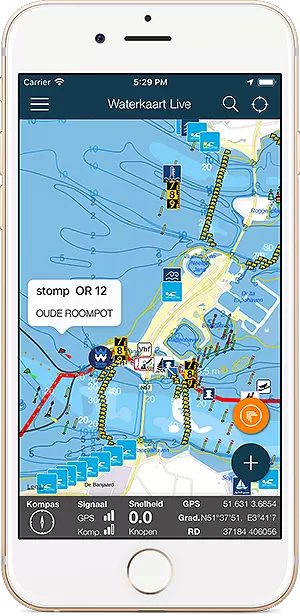
Always have the current bridge and lock times at hand? With the Water Map Live app you stay informed.

Screenshot app Water Map Live

Download the app for iOS or Android.

Download Water Map Live, app for Android  Download Water Map Live for iPhone and iPad

About Water Map Live

Water Map Live is the water website and app of the Netherlands. Here you will find the most important information that you need as a nautical professional, water sports enthusiast, swimmer, water lover or weather enthusiast. Fast and complete.

Do you have good ideas or suggestions, do you want to collaborate or reuse data? Let us know, we'd love to hear from you!
 
Water Map Live for free in your website

Want to know more about Water Map Live?
Surfcheck / Waterkaart Live
Rijn en Schiekade 115 F
2311 AS Leiden (NL)
Get in touch
Kvk: 61380431

post@waterkaart.net
 
Frequently asked questions

Download Water Map Live
 
Download Water Map Live, the app for Android   Download Water Map Live, the app for iPhone and iPad